Seattle weather: Stunning spring sunshine the next few days
SEATTLE - An upper level ridge of high pressure will settle in over the Pacific Northwest the next few days, bringing sunshine and warmer temperatures to Western Washington.
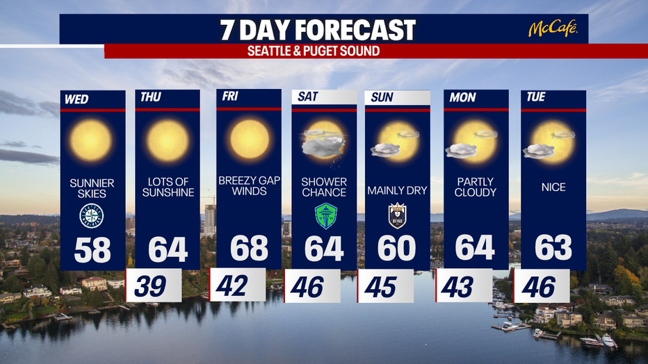
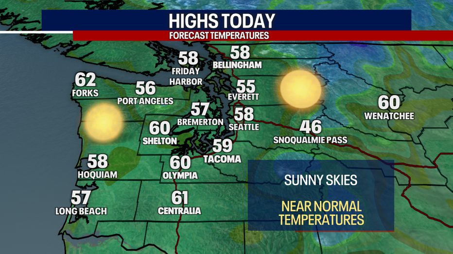
Other than a few morning clouds, sunshine will dominate Wednesday with highs near normal for mid-April.
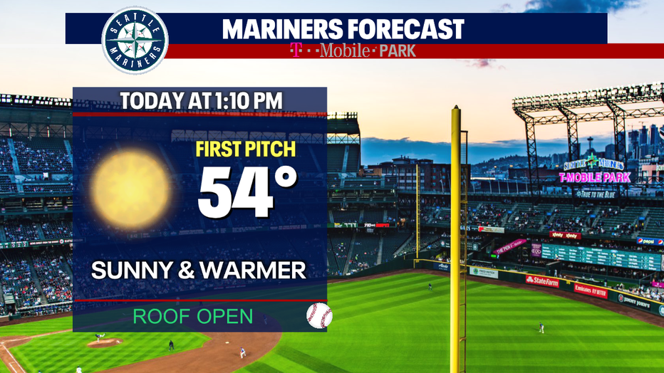
If you're heading to T-Mobile park for some day baseball, it's going to be a beautiful afternoon for baseball. Temps will be in the mid 50s at first pitch and warm to the upper 50s by the end of the game. Getting a spot in the sunshine will help it feel warmer.
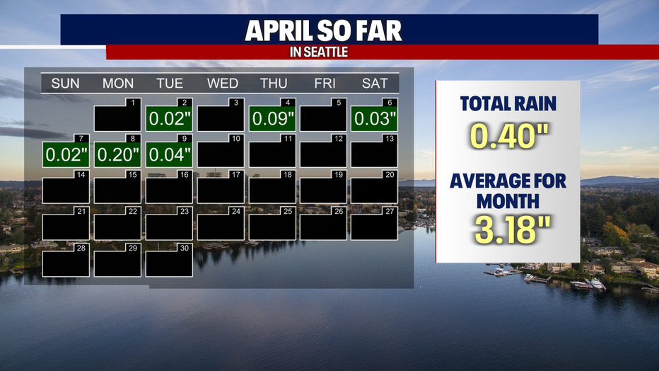
It has been a very dry April so far, with less than a half inch of rain in the bucket at Sea-Tac. The next week looks mostly dry, so we won't be catching up much to the average of 3.18 inches.
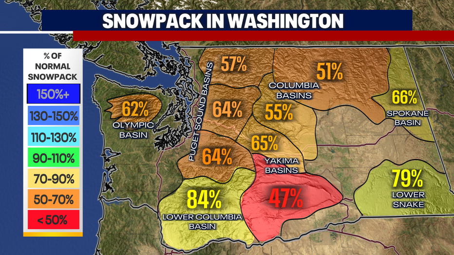
A very dry March and first half of April has decreased our snowpack even more in the mountains. The Puget Sound basins are between a half and two-thirds of normal. The southern Yakima basins are in rough shape with less than half of the normal snowpack.
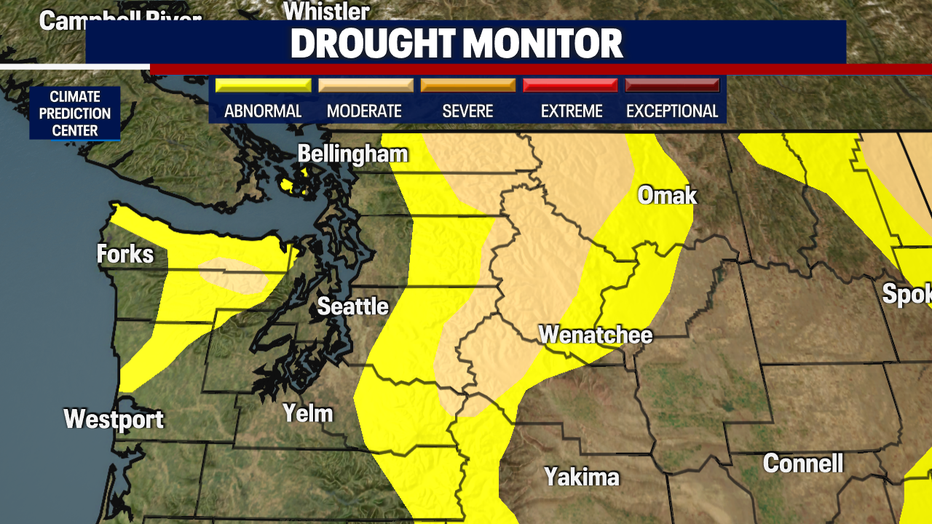
These dry months in the Northwest are leading to moderate drought conditions in the northern and central Washington Cascades and parts of Central Washington. A dry spring can lead to an active wildfire season.
It's going to be very pleasant in the lowlands the next seven days. As the ridge of high pressure pushes east Friday, we will likely see some stronger Cascade gap winds in the western foothills. Models are pushing in a weak front on Saturday, which will bring some rain showers to the area Saturday afternoon and evening.
Early next week looks great, with partly cloudy skies and highs in the 60s.