

Weather Alert Day: Smoky conditions continue through the weekend
Smoky weekend forecast as wildfires spark up in the Puget Sound region
Smoky weekend forecast as wildfires spark up in the Puget Sound region
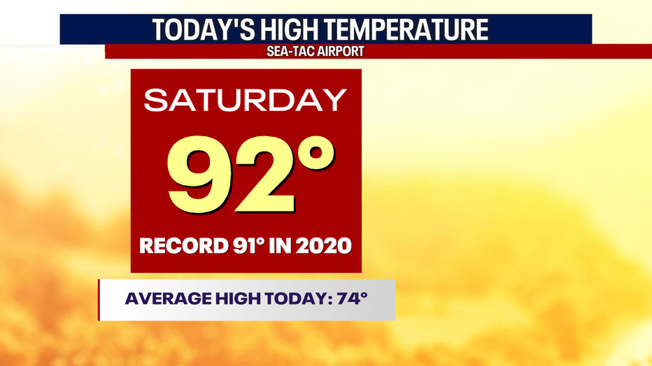
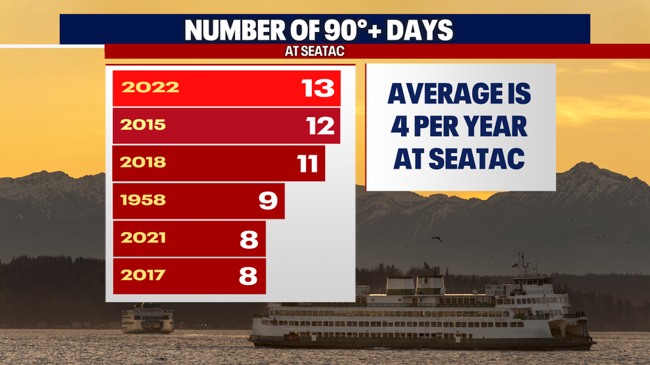
Seattle - The smoke did not prevent the heat this afternoon at SeaTac. We topped out at 92 degrees - breaking the daytime record of 91F! We have seen 13 days of 90 degree + temperatures, making for a new all-time record in a year! Sheesh.
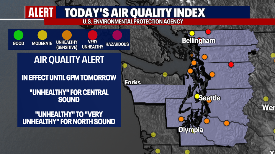
It was hard to miss the smoky haze today, let alone smell it! Reduced visibilities quickly became an issue as a new fire sparked up near Skykomish, closing down highways and starting evacuations for some. An *Air Quality Alert* remains in effect through tomorrow evening as the smoke hangs around.
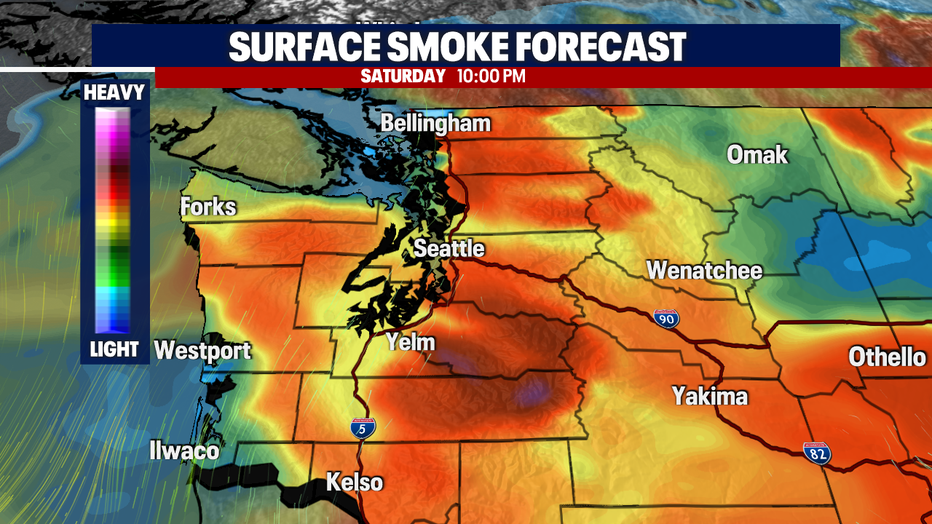
The smoky conditions will begin to improve tomorrow evening for most! On shore flow begins tomorrow. The winds will shift, and this begins to clear up most of the smoke at the surface by tomorrow evening.
Here is a look at your smoke forecast:
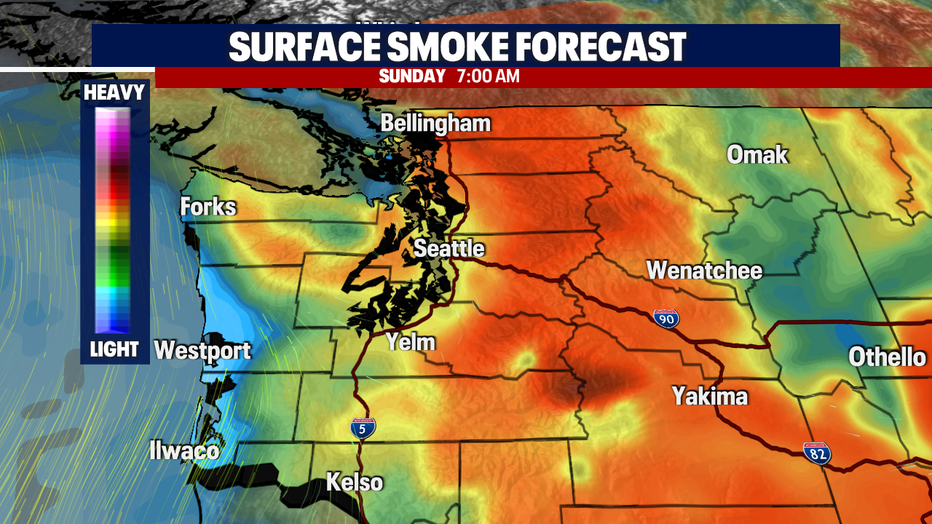
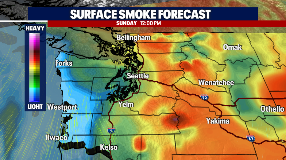
Expect a smoky start to your Sunday! Take a look at how we start to clear up along the coast tomorrow afternoon:
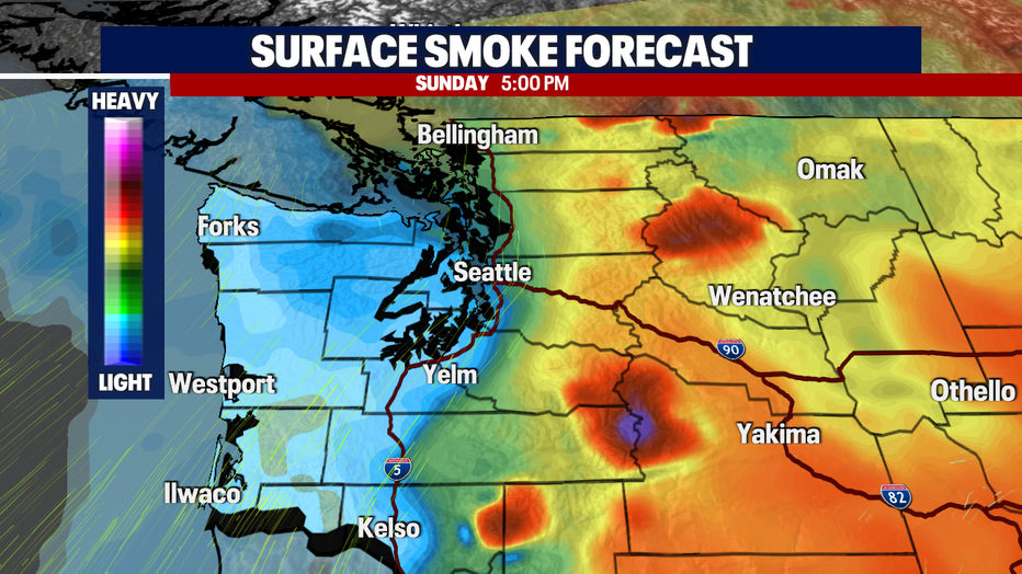
We could begin to see come improvement tomorrow evening. Check out the 5pm forecast:
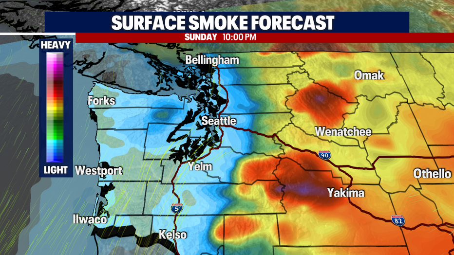
Surface smoke continues to clear as we head into Monday:
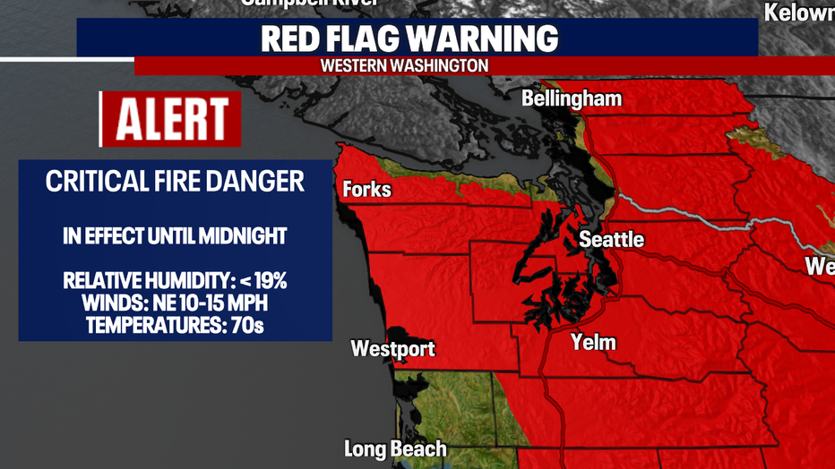
Now, as the smoke continues this evening, the *Red Flag Warning* continues. It continues to be very dry out there, and it won't take much for another fire to spark up. Please be mindful as we remain under this rare fire warning.
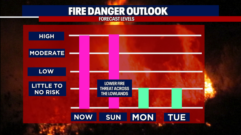
Fire danger significantly improves on Monday. Scattered showers will be possible across the foothills and Cascades as we kick off the work week. They will be spotty and more isolated across the lowlands, but we'll take it!
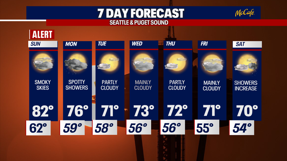
Here is a look at your 7-day forecast:
Washington Wildfires
- Washington Air Quality Map
- INTERACTIVE MAP: Wildfires in Washington, Oregon, Idaho, California
- Wildfire outlook: Red Flag Warnings, air quality alerts and smoke forecast
- Wildfire smoke: How to protect yourself, your home from hazardous air quality
- Evacuation orders underway, accidental emergency alert lands on phones across Snohomish County
Stay safe out there!