

Seattle heat wave will likely break record for longest stretch of consecutive days in the 90s
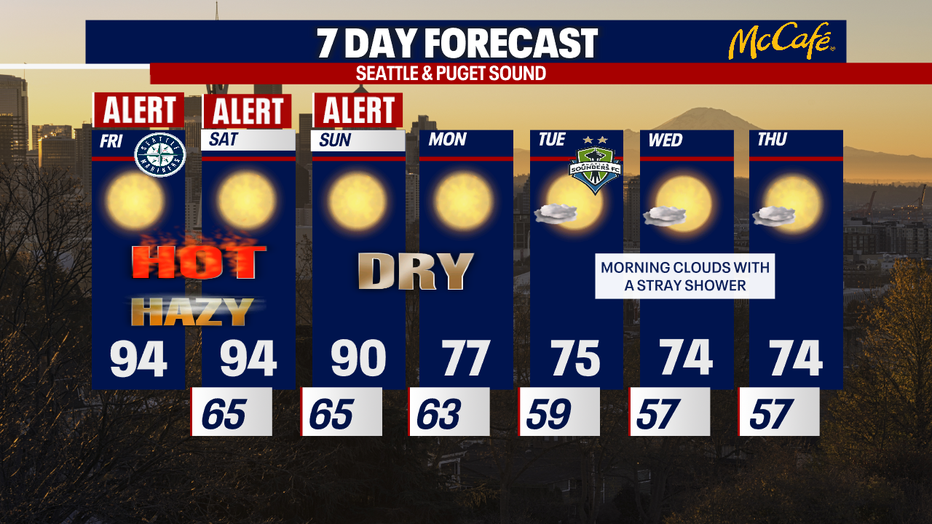
The sweltering heat continues! In fact, this week will likely go down as the longest stretch of consecutive days at or above 90-degrees at Seattle-Tacoma International Airport (six days in a row). We'll finally get some relief by Monday.
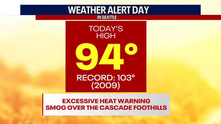
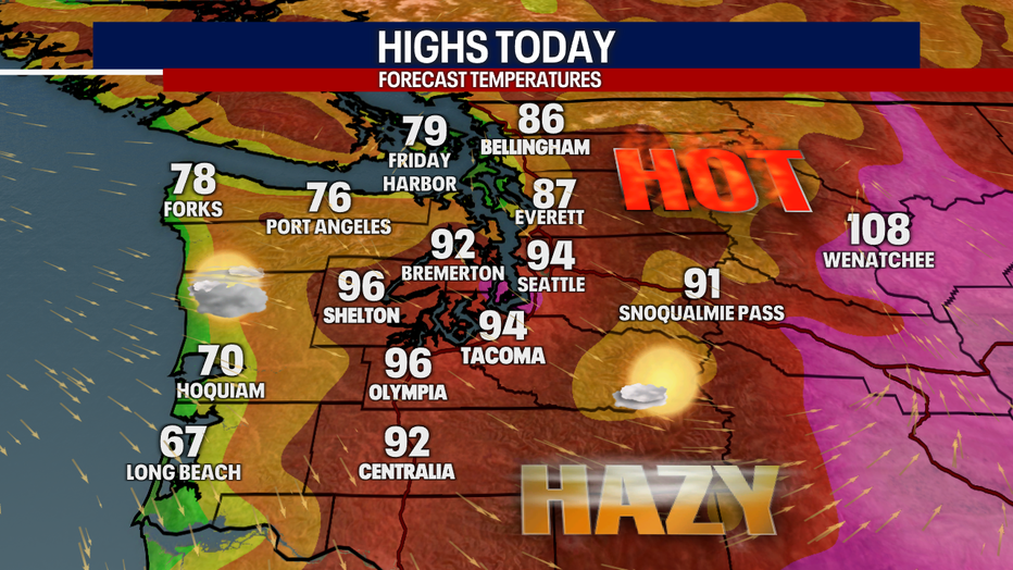
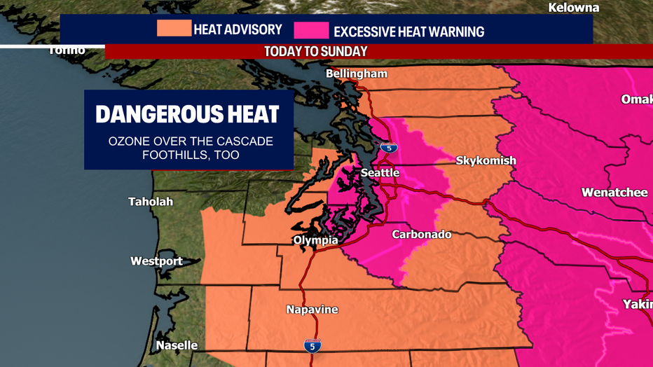
Highs today will soar once again to the mid 90s for many in Central and South Puget Sound. The hottest temps today will be in the metro areas (buildings and pavement absorb more solar radiation than vegetation and outlying areas) and in the Cascade foothills (some communities like Issaquah and North Bend could see highs flirting with the triple digits).
Even though temps are skyrocketing more than 15 degrees above-average in Puget Sound, the coast is significantly cooler thanks to a weak marine layer. Each morning should start gray along the coast this week. Highs today will be limited for places like Forks, Aberdeen and Long Beach.
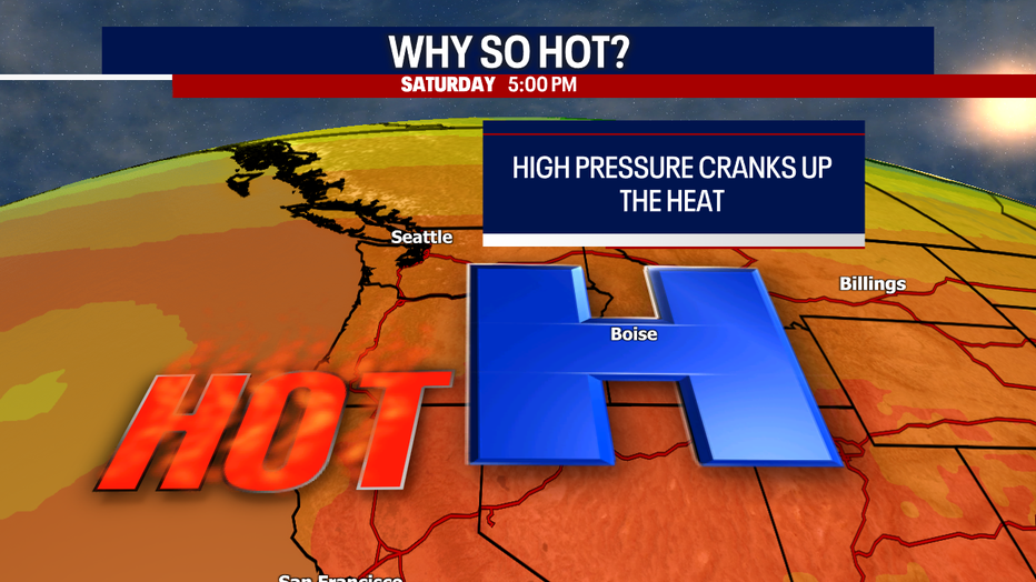
Here's why we're tracking the heat: a dome of high pressure is cranking up temperatures – big time. This same "weather maker" can give us a stagnant air pattern, trapping fog along the coast, too.
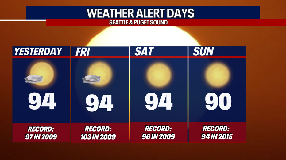
The latest forecast models are calling for the 90s to overstay its welcome (depending upon your perspective), lingering into Sunday. Because of this, the National Weather Service is extending Heat Advisories and Excessive Heat Warnings until Sunday. Check it out:
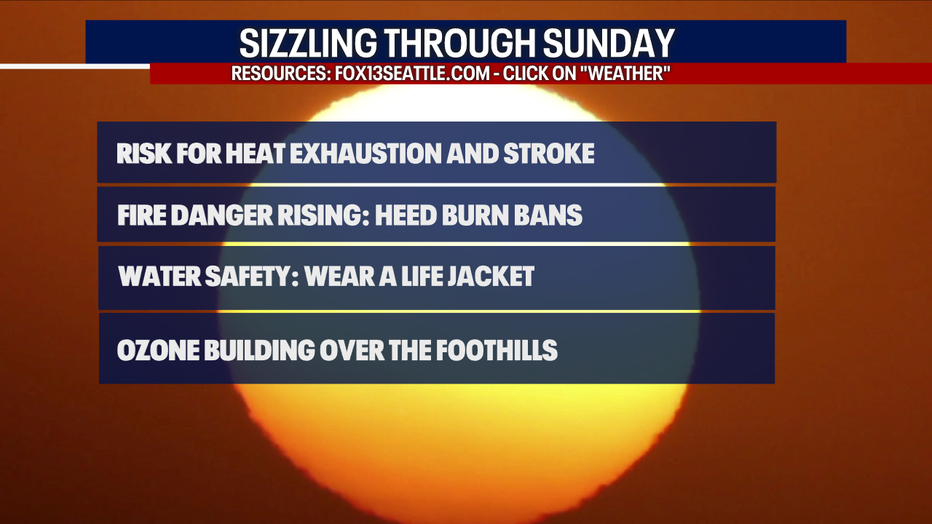
We're still worried about heat exhaustion and heat stroke. Fire danger remains elevated. Make sure to practice water safety and wear a life jacket if you're going to river, creek or lake.
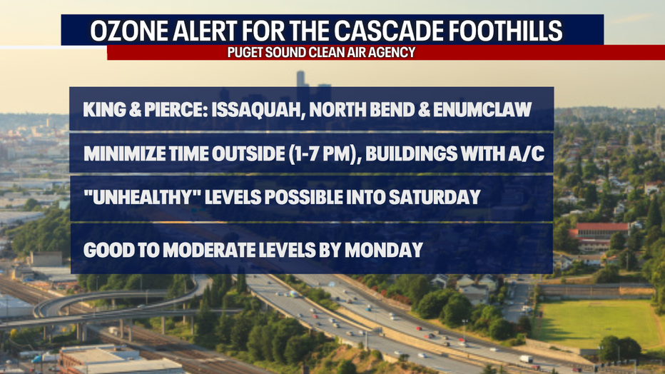
Let's talk about the air quality issues. Puget Sound Clean Air Agency issued an Ozone Alert that remains in effect for the Cascade foothills of Pierce and King Counties, including communities like Issaquah, North Bend and Enumclaw.
If you're in a "sensitive group" (if you're over 65 years old, are pregnant, have COPD, asthma or other respiratory issues), minimize your time outside in the afternoons and evenings. Head into a building with cool and clean air.
Even those without respiratory problems may be impacted by the smog today and/or tomorrow over the Cascade foothills. Thankfully, "good" to "moderate" air quality on tap by Monday.
For more information, click here.
Relief from the heat is finally on the way by Monday. Thanks to a strengthening onshore flow, highs will drop down to the 70s and stay there through at least Thursday. This westerly push will help scour out pollutants in the air – giving way to improving air quality.
Sometime between Tuesday and Thursday, there could be an isolated shower. I'm hoping we won't be dealing with lightning as that could ignite wildfires after this hot and dry weather.
Stay cool and hydrated this weekend!
Warmly,
Meteorologist Abby Acone
Follow me on Twitter @abbyacone, Instagram @abbyaconewx, TikTok @abbyaconetv and Facebook (Meteorologist Abby Acone)