

Parts of Western Washington tie or break record low temperatures Wednesday
Parts of Western Washington ties, breaks record low temperatures Wednesday
Parts of Western Washington tied or broke record low temps Wednesday morning.
SEATTLE - Wednesday morning started off with chilly temperatures and at about 6 a.m., we tied a record low at 24 degrees at Seattle-Tacoma International Airport.
We reached a high of 35 degrees Tuesday, which is 16 degrees below average! Now, as the clouds clear and the wind speeds die, we'll get ready for record-breaking low temperatures.
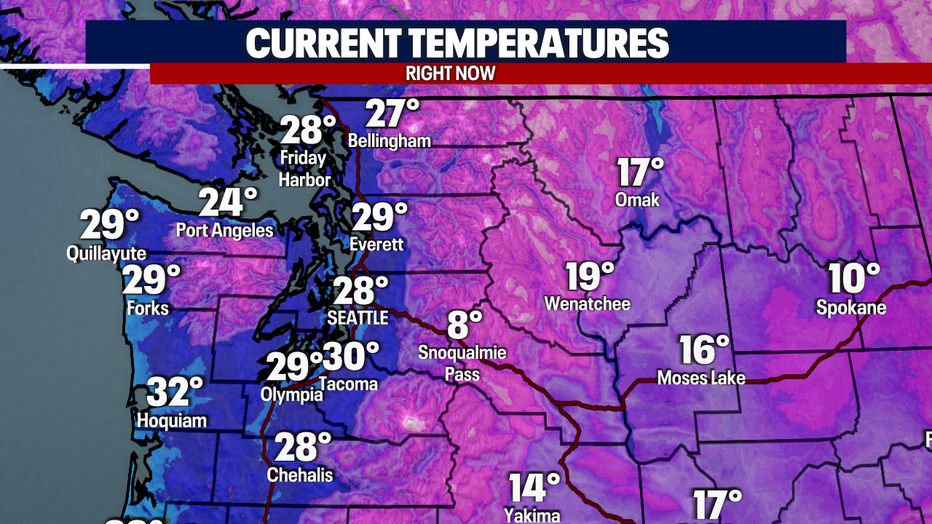
Here is a look at temperatures at 10:40 p.m. Tuesday: We were already down into the 20s!
By Wednesday morning it was brutally cold. Make sure you bundle up, protect your pets when you take them outside, and check in on loved ones.
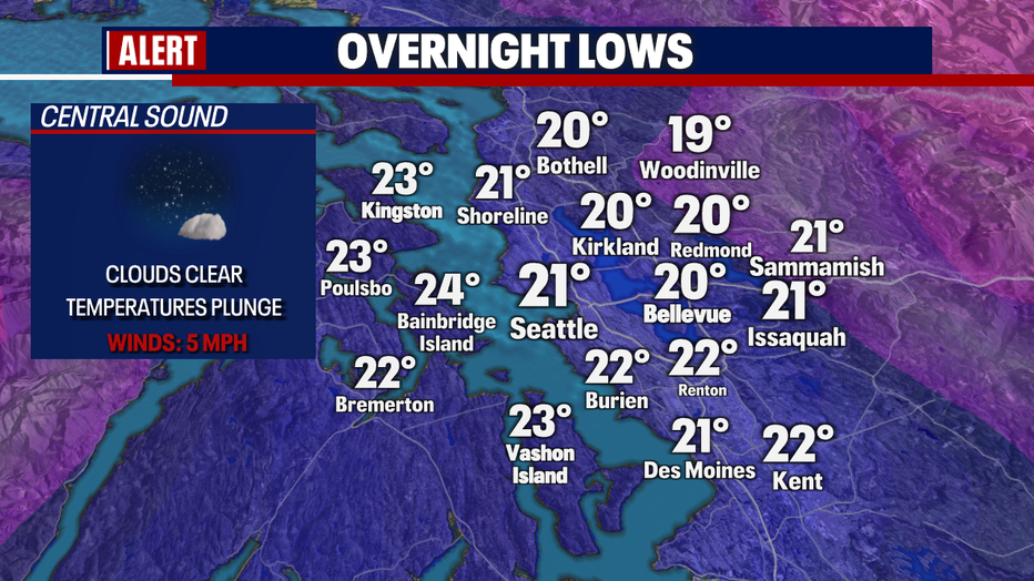
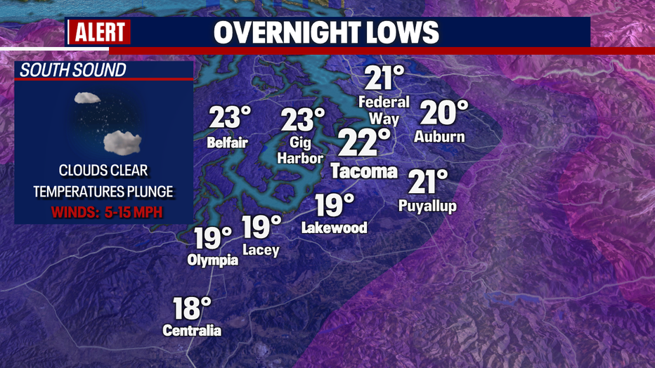
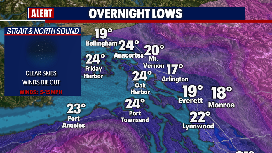
Here is a look at those overnight lows:
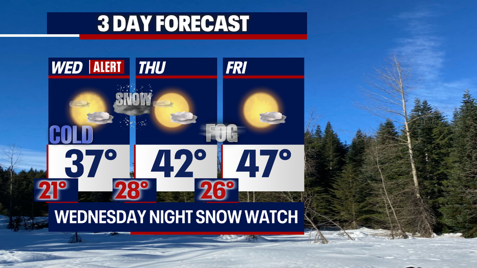
Temperatures will return in the 30s Wednesday afternoon. The sun will be out early, but it won't be strong enough to help "warm" us up. We'll see some improvement in our afternoon highs by the end of the week so don't you worry!
We'll be tracking a new disturbance, late Wednesday, that will trigger the possibility of more snow! Our best shot for snow will take place across the North Sound. This is where we could see a light dusting and even 1-2" of accumulation.
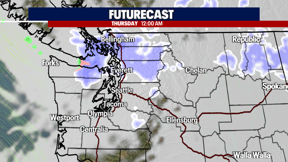
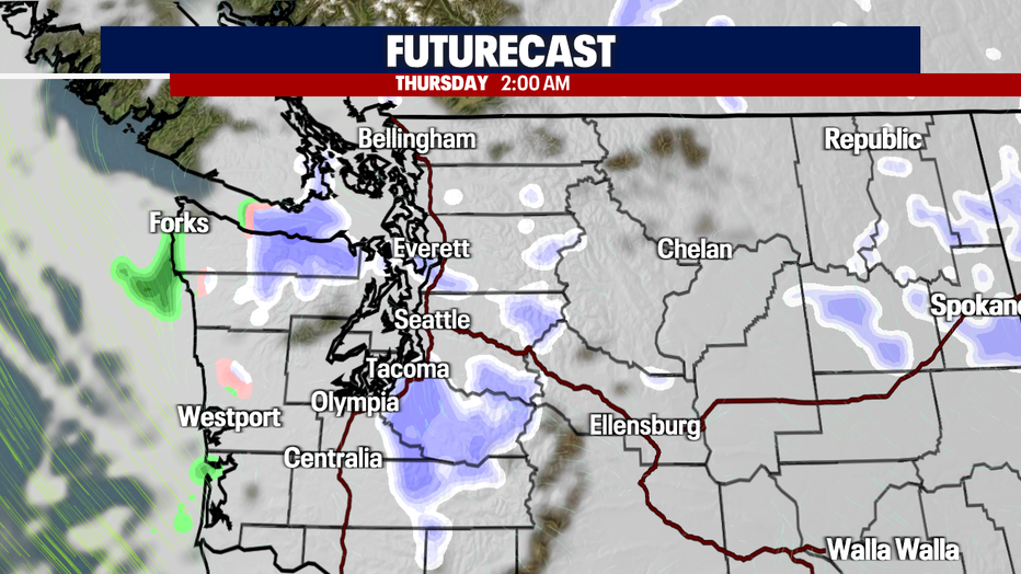
Here is a look at the latest IBM model:
Have a good one and stay warm out there!
MORE FROM FOX 13 WEATHER:
DOWNLOAD: FOX 13 Weather and News Apps
WATCH: Forecast and Radar
READ: Closures and Delays
CHECK: Latest Weather Alerts and Live Traffic Map
INTERACT: Submit your Weather Photo
DAILY BRIEF: Sign Up For Our Newsletter
FOLLOW: Lisa Villegas, Erin Mayovsky, Brian MacMillan, Abby Acone and Scott Sistek