

Rainy weather continues bringing increased landslide threat
SEATTLE - There is an increased threat for isolated landslides across Western WA below 5,000' due to recent heavy rain and saturated ground. If you suspect a landslide, evacuate immediately and report it to WA DNR.
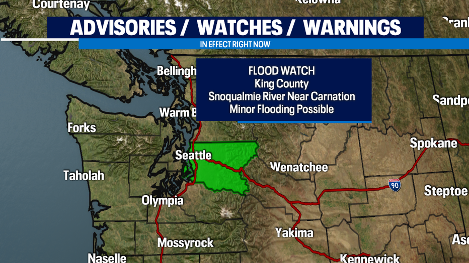
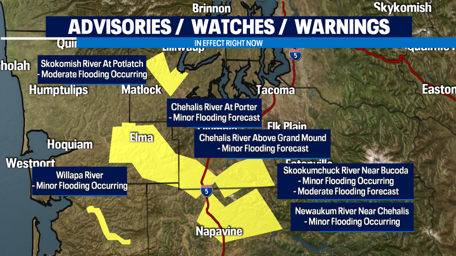
Multiple area rivers are flooding or expected to flood today. Minor flooding is possible for the Snoqualmie River near Carnation so for that reason, a Flood Watch is in effect for King County. Remember, turn around, don't drown!
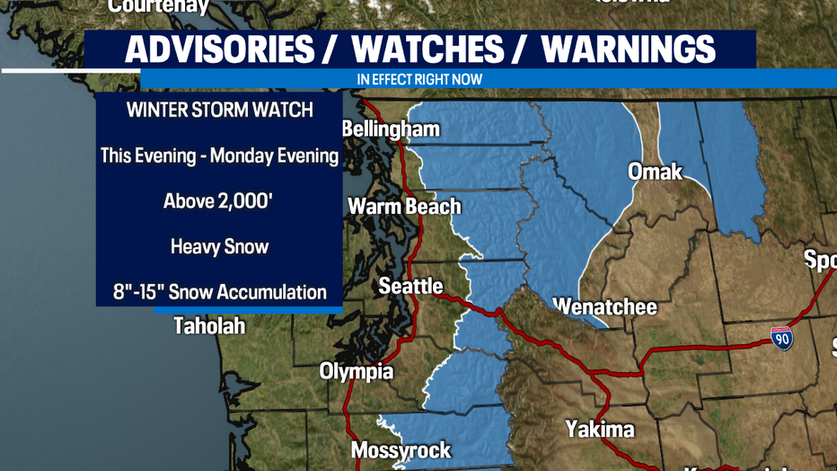
Travel in the passes will be hazardous again. A Winter Storm Watch will be in effect for the Cascades this evening through Monday evening. Snow levels will stay around 2,500' today but climb tonight and tomorrow to 4,000' as a warm front lifts bringing widespread rain and mountain snow. Be careful and check pass conditions before heading out!
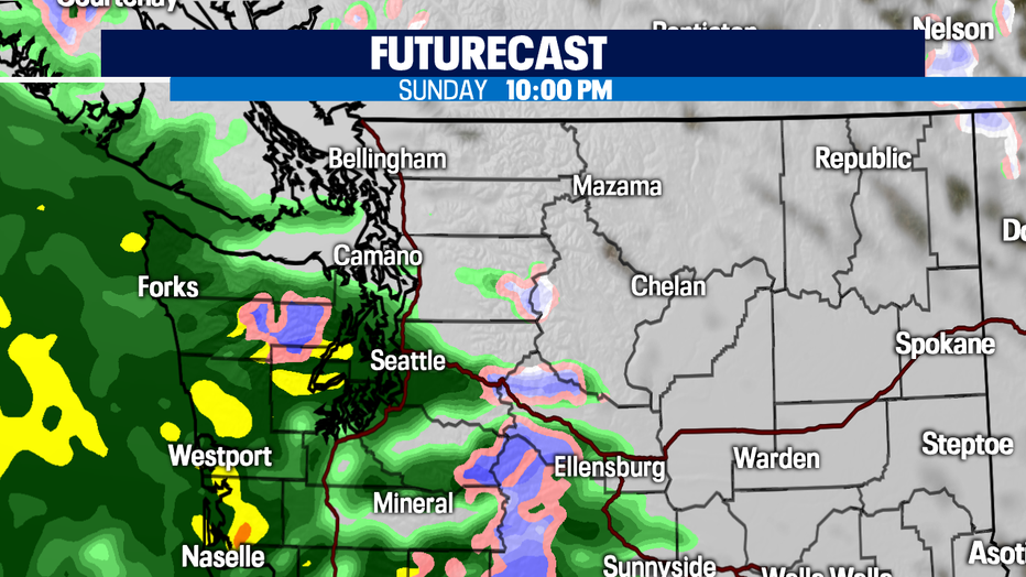
In the lowlands, we'll start to dry out from this morning's rain. A few showers are possible this afternoon but our next round of widespread rain comes this evening and tonight. Expect a wet and breezy Monday.
Rain will be scattered in nature for Tuesday but another system arrives Tuesday night into Wednesday bringing widespread rain and breezy conditions. Thursday looks mostly dry before another system approaches Friday.
Be safe!
-Q13 Meteorologist Grace Lim