

Rain shifting north, drier weather ahead for the long weekend
SEATTLE - An atmospheric river is shifting north this morning, bringing much drier weather to Western Washington this afternoon.
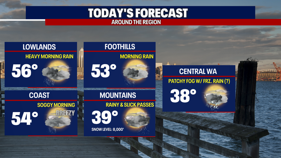
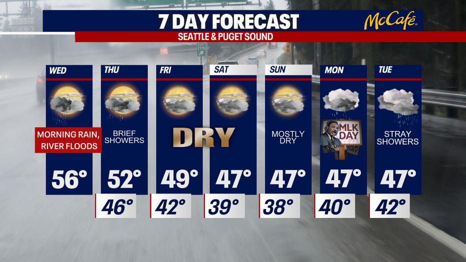
It has been a very wet 24 to 36 hours across Western Washington, but drier weather is right around the corner. The steady rain heads north into Canada today, with warm temperatures sticking around this afternoon. Highs will top out in the mid to upper 50s. I wouldn't be surprised if a few spots touch 60 degrees today with sunbreaks.
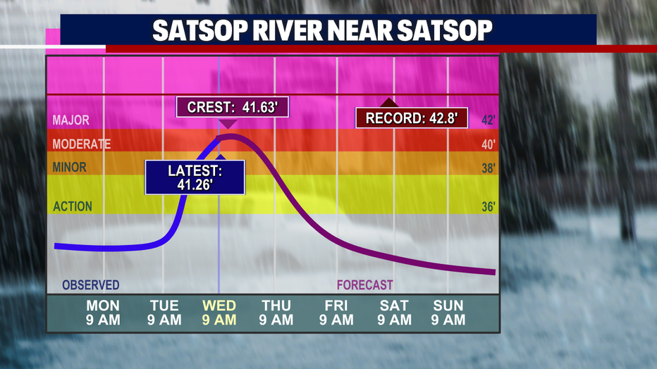
Even with the rain moving on, there are still some rivers will be keeping an eye on. The Satsop River is cresting in "moderate" flood stage this morning, but waters will remain high through tonight.
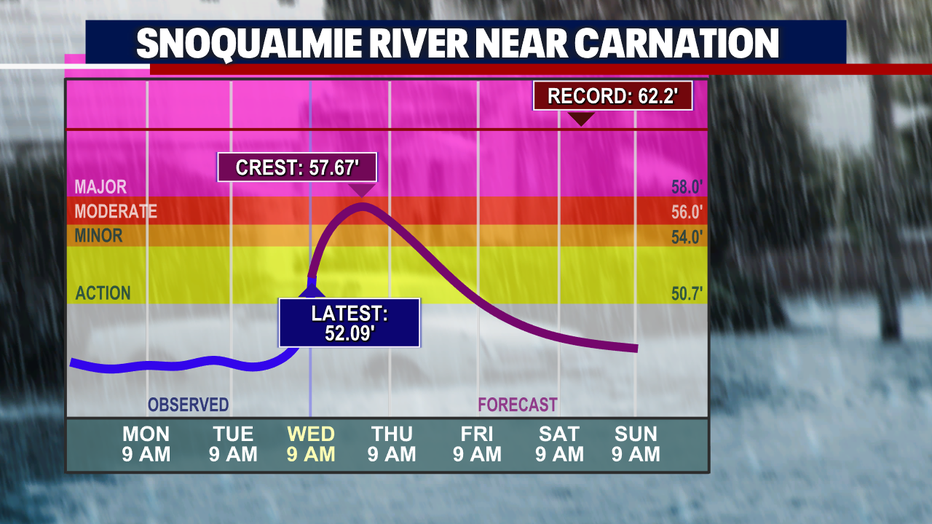
The Snoqualmie River near Carnation and the Snohomish River near Snohomish will crest later tonight in "moderate" flood stage.
Thursday will bring some brief morning showers as a cold front sweeps through the area, followed by a partly cloudy and dry afternoon. High temps will be a bit cooler, but still mild for this time of year.
Our first three-day dry stretch since September 23 to 25 is possible Friday through Sunday, with patchy morning fog and otherwise mostly cloudy skies. The next wet system arrives late Sunday night into early Monday morning.
MORE FROM FOX 13 WEATHER:
DOWNLOAD: FOX 13 Weather and News Apps
WATCH: Forecast and Radar
READ: Closures and Delays
CHECK: Latest Weather Alerts and Live Traffic Map
INTERACT: Submit your Weather Photo
DAILY BRIEF: Sign Up For Our Newsletter
FOLLOW: Lisa Villegas, Erin Mayovsky, Brian MacMillan, Abby Acone and Scott Sistek