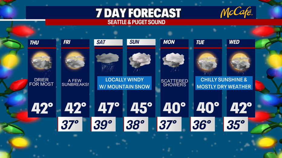
Mainly dry and cool the next two days
Mostly cloudy skies, few possible sunbreaks
We're tracking isolated showers today, mostly dry weather Friday, and stormy weather by Saturday.
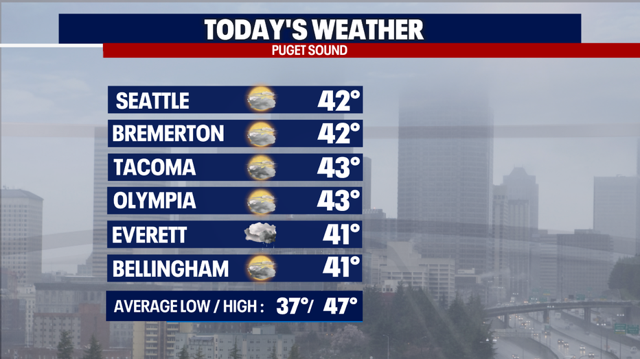
Seattle - Good morning!
Happy Friday Eve :) We're tracking isolated showers today, mostly dry weather Friday, and stormy weather by Saturday.
Today, mostly cloudy skies are on deck. A few sunbreaks are possible, too! Only stray showers will pop up in Western Washington today. A weak convergence zone will trigger some light rain in parts of King, Snohomish, and Skagit Counties. Highs stay cool this afternoon, only reaching the low 40s for most. Enjoy the dry weather, but make sure to bundle up.
Friday stays chilly, but the day will end up dry for most backyards. By late Friday evening, our next storm system will be knocking on our door. It'll be a soggy evening for the coast, but Puget Sound won't see rain until early Saturday.
Starting Saturday morning, winds pick up along the coast. Gusts could reach 40-45 mph for the coast, San Juans, Bellingham, Port Townsend, Whidbey/Camano Islands and Mt. Vernon. Elsewhere in the Puget Sound lowlands, gusts could blow to 30-40 mph. Important note: if this incoming storm system tracks farther south, winds could be stronger than what we're forecasting right now. Stick with us!
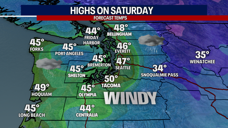
On top of the winds, rain could be heavy in the lower elevations. The heaviest rain will fall Saturday afternoon to early Sunday. During this time, mountain snow will be ramping up. There could be a foot or more of snow for the mountain passes by Sunday morning. If you have any fun holiday travel plans this weekend, make sure to check our forecast and conditions with WSDOT before heading over the passes. The best time to travel over the mountains this weekend will be Friday and again Sunday.
Christmas week starts cool. A couple sunbreaks are a potential, too.