

Seattle weather: Lowland rain, mountain snow and breezy wind this weekend
Seattle weather: Widespread rain returning this weekend
Seattle weather: Widespread rain returning this weekend
SEATTLE - Light showers Friday will turn heavier this weekend as a frontal system moves through the Pacific Northwest.
As a ridge of high pressure moves east, a low pressure system off the coast of Canada will send a cold front sweeping through Western Washington this weekend.
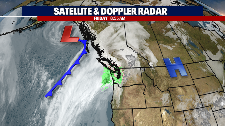
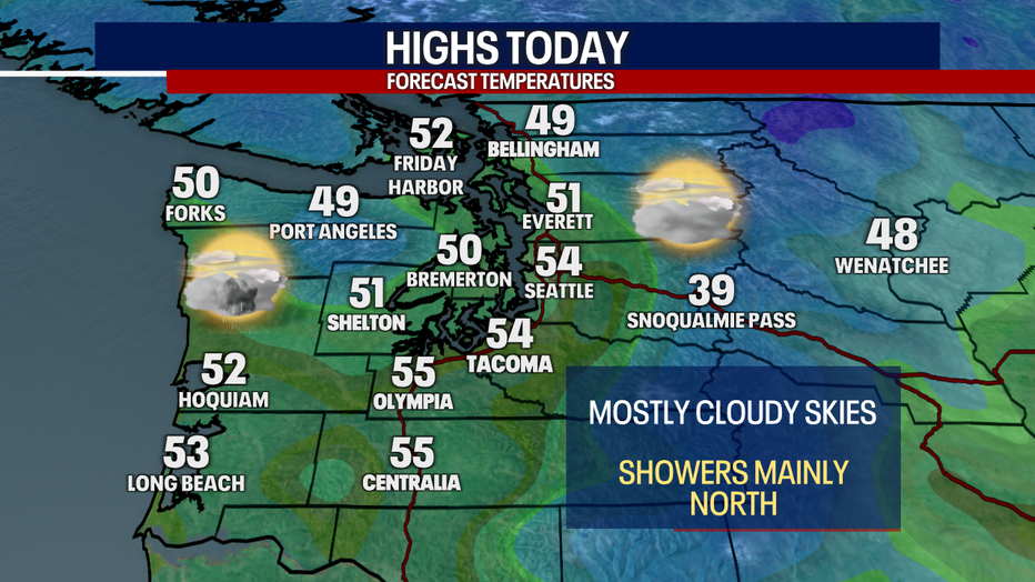
After almost two weeks of below average temperatures, Western Washington will be looking more mild Friday with highs in the mid 50s for the central and south Puget Sound areas. Showers will linger this afternoon in the north sound and along the northern Washington Coast.
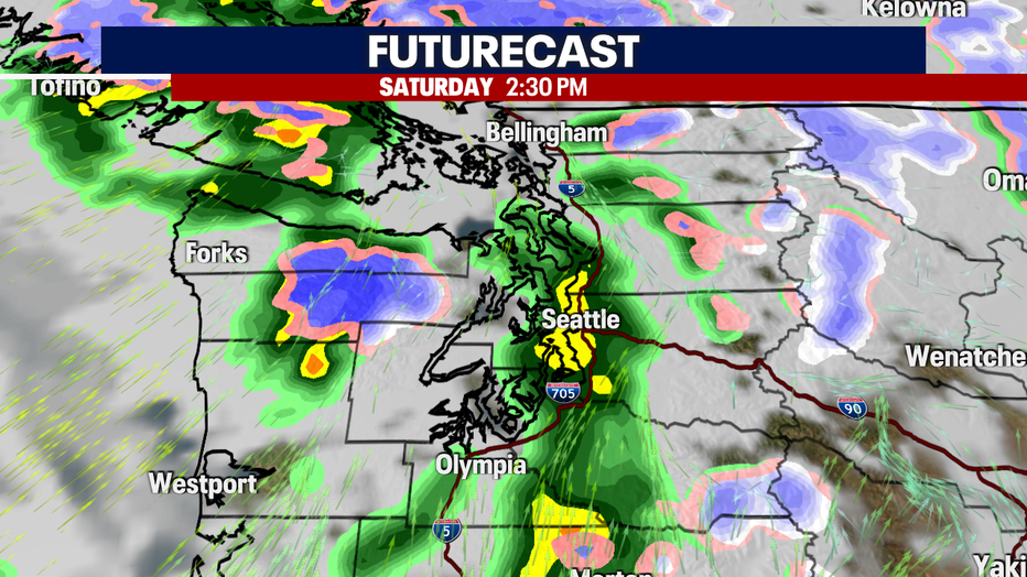
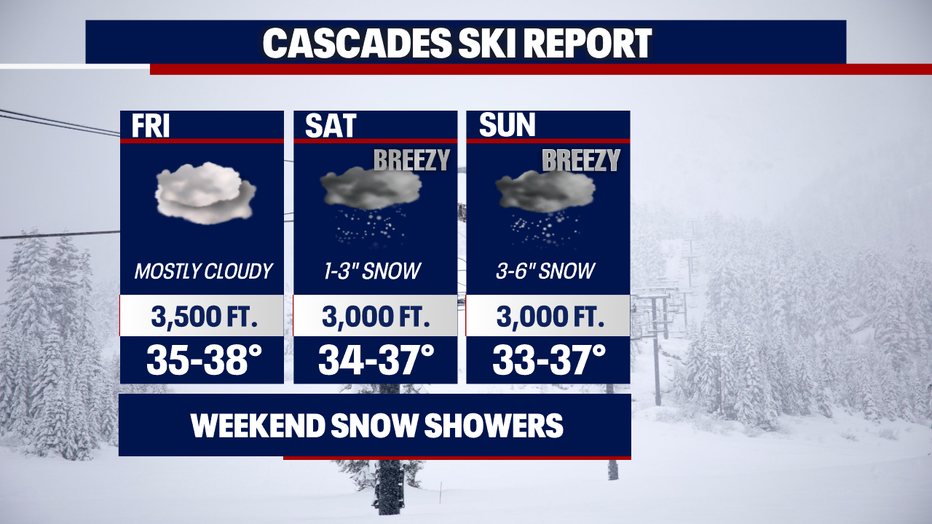
The front will stall offshore most of Friday, but it will finally make progress east on Saturday. This will bring widespread rain showers starting Saturday morning and continuing through most of the weekend. Wind will be breezy at times on Saturday. Heavier rain and gustier winds are expected on Sunday.
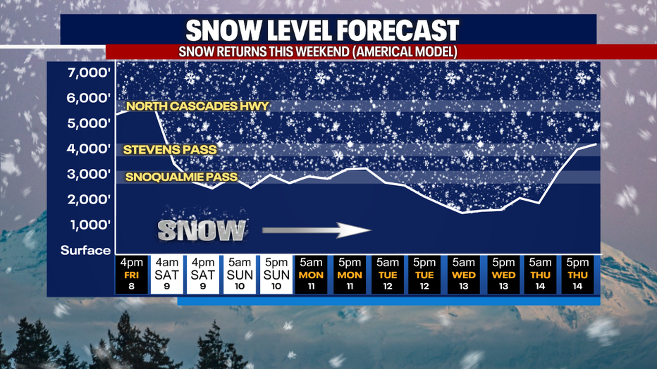
In the mountains, snow levels will drop this weekend to around 3,000 feet. One to two feet of snow is possible in the Cascades through the middle of next week. This is great news for the struggling snowpack.
Tuesday and Wednesday, showers will taper off and we'll be looking at warming temperatures by the end of next week. Models continue to suggest a warmup for St. Patrick's Day weekend. Highs could be in the 60s that weekend for a nice taste of spring.
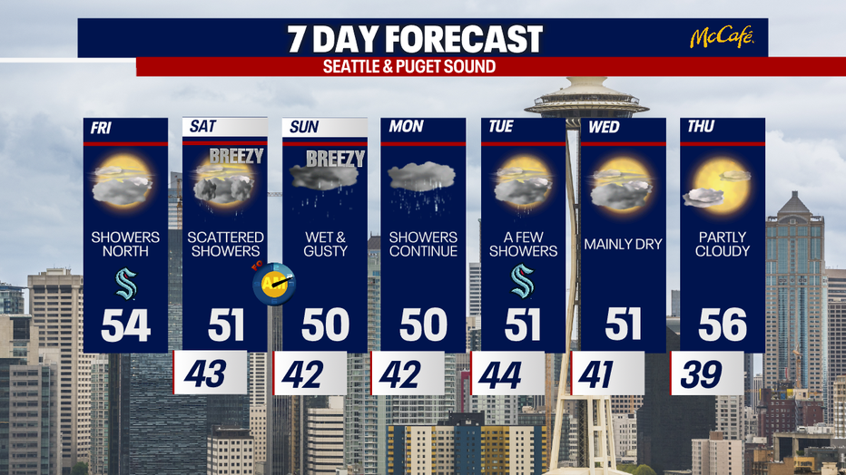
Remember to adjust your clocks ahead one hour early Sunday morning. Daylight Saving Time officially begins Sunday, bringing our first 7:00 PM sunsets of the year that night.