Seattle weather: Last warm day in Western Washington for a while
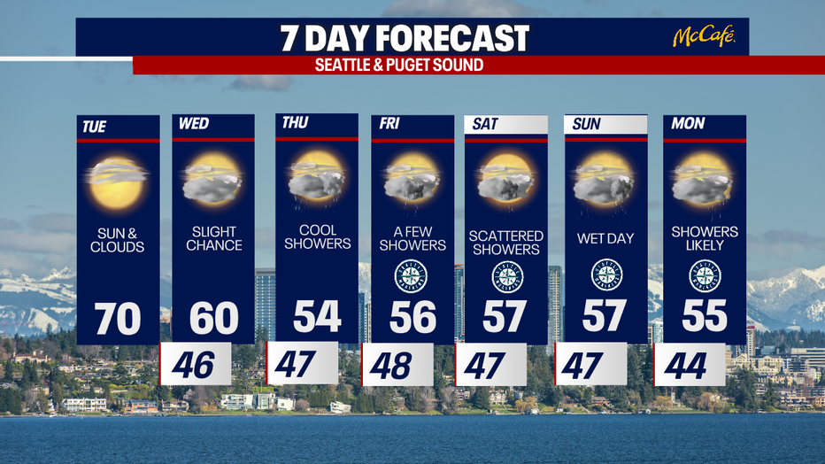
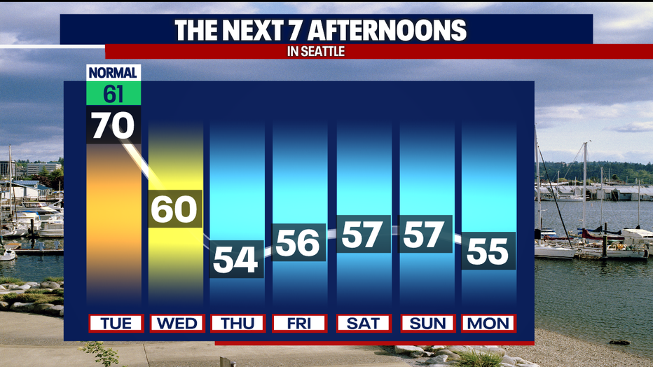
SEATTLE - Tuesday will be the last warm and sunny day for a while, as a much cooler and wetter weather pattern sets up through the weekend.
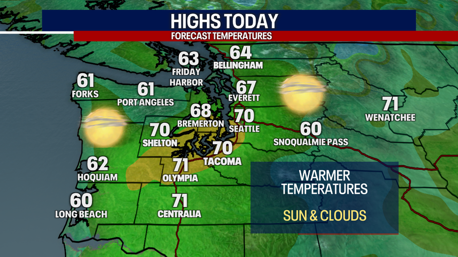
High pressure over the Pacific Northwest will bring warm filtered sunshine, with high clouds Monday. Highs will be close to 70 degrees in the central and south Puget Sound areas.
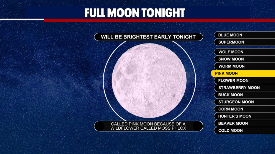
Tonight's full moon is called the Pink Moon, named after a wildflower in the northeast United States.
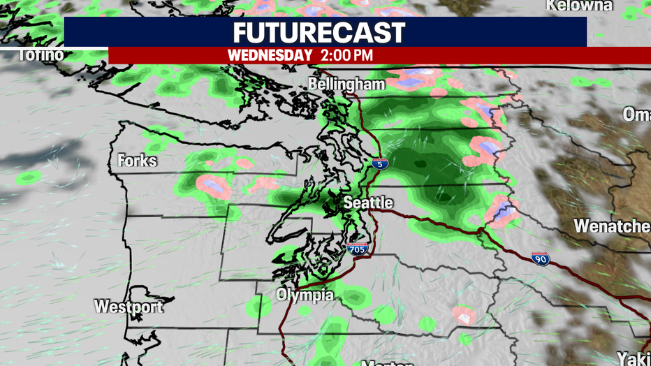
Onshore flow will push in clouds and showers Wednesday. The best chance for rain will be in the higher elevations, though anyone could see a light shower or two.
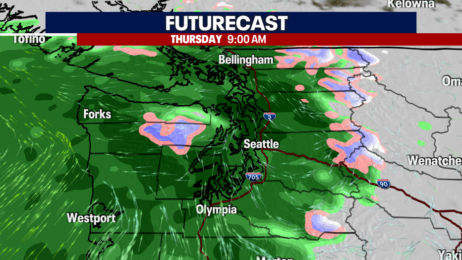
Widespread rain will hit Thursday as a trough moves inland. This will also usher in a cooler airmass, dropping high temperatures into the mid 50s.
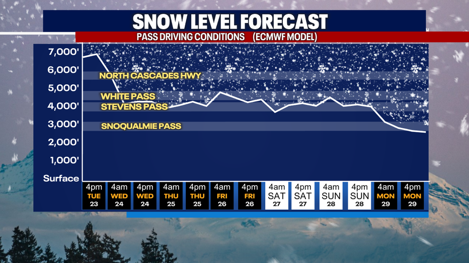
With the colder air in place, snow levels will drop on Wednesday, down to around 4,000 feet. Snow levels will bounce between 4,000 adn 5,000 feet through the weekend, which could mean some light snow accumulations or a rain and snow mix over the higher mountain passes.
Enjoy today, because temperatures will drop dramatically over the next two days. Long range models are keeping us cooler than average in Western Washington even beyond the seven day forecast.
If you're heading to any of the Mariners games later this week and over the weekend, the roof will likely be closed with showers expected every day starting Thursday.