Seattle weather: Hot and hazy for Fourth of July celebrations in Western Washington
Warm, smoky skies to return Monday
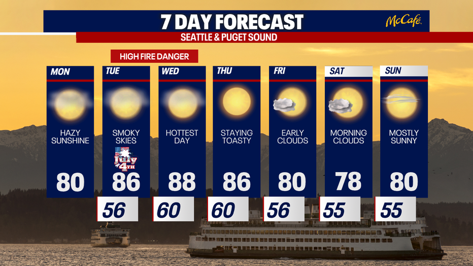
Get ready for another warm day! Temperatures will rise into the 80s for those across parts of the Puget Sound. We'll continue with dry conditions, but smoky skies return to Washington from the wildfires in Canada.
Seattle - Western Washington is heating up the next few days as high pressure builds over the Pacific Northwest.
Highs will be in the 80s for the central and south sound with hazy sunshine Monday afternoon.

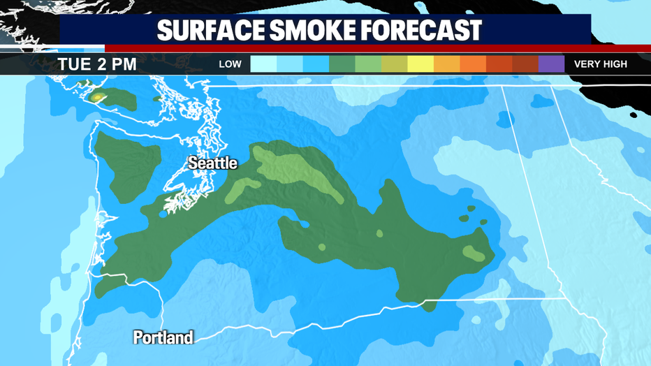
Smoke from Canadian wildfires is expected to move into the state the next two days. You'll notice a more hazy look to the sky starting Monday afternoon.
Tuesday, the smoke will be thicker with a chance for worsening air quality at the surface. Air quality is still expected to be in the "good" or "moderate" categories, but you may smell some smoke at times.
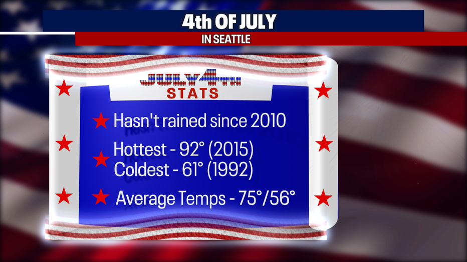
Western Washington has seen dry weather on the 4th of July the past twelve years. This year, we'll continue the dry streak.
The hottest 4th of July on record was just a few years ago in 2015 when we hit 92 degrees. The coldest 4th of July on record was also our wettest. In 1992 we only hit 61 degrees and had .57 inches of rain for the day. That's a good soaking for this time of year.
Temps will be heating up over the next few days as high pressure moves over the region. Temps will flirt with record highs on Wednesday, but should cool again heading into next weekend with the return of onshore flow.
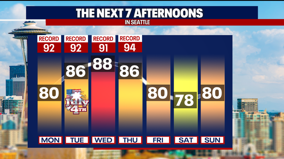
There will be a heightened danger for wildfires the next few days as temperatures climb, humidity levels drop, and breezy afternoon winds blow. There's no rain in sight for at least the next ten days, so be extra careful with fireworks over the holiday.