High fire danger Friday and Saturday
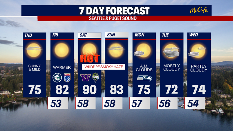
Sunny and mild Thursday, with temperatures reaching 90 degrees this weekend
Sunny and mild Thursday, with temperatures reaching 90 degrees this weekend in the Seattle area.
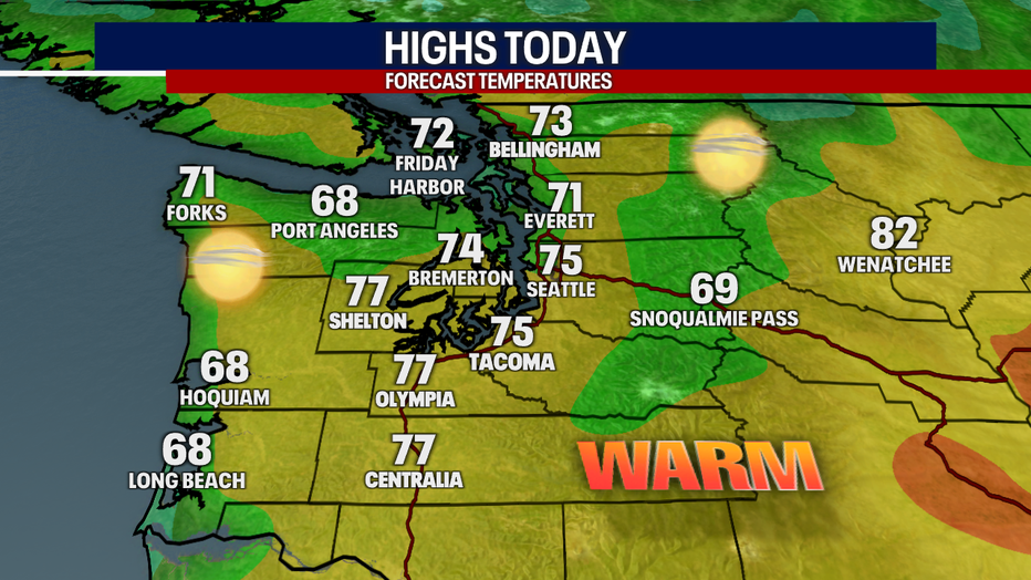
Seattle - It will be a comfortable and cooler Thursday with highs in the mid 70s, but a strong ridge of high pressure will move over the region Friday and Saturday sending the region into mid-summer heat once again.
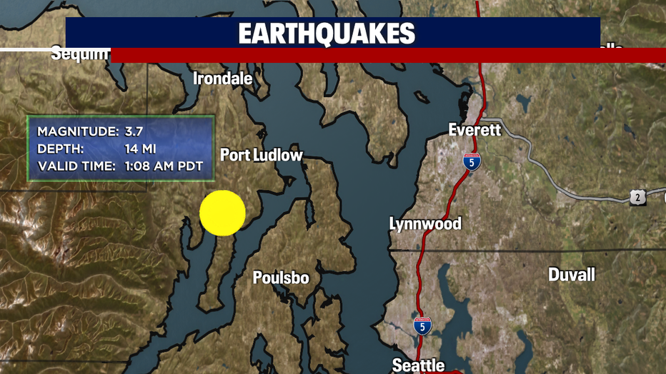
Early this morning, a small earthquake shook the central Puget Sound area. The quake hit south of Port Ludlow and northwest of Poulsbo registering a 3.7 magnitude. There were no reports of damage or injuries.
Expect sunny skies all day Thursday with cooler afternoon high temperatures in the mid 70s.
Friday and Saturday will bring high fire danger to Western Washington as a ridge of high pressure moves overhead. Both days will be very warm with breezy easterly winds, especially in areas around the gaps of the Cascades. Gusts there could reach up to 40 mph. With this hot, dry, fast moving air incoming, a small wildfire can quickly grow.
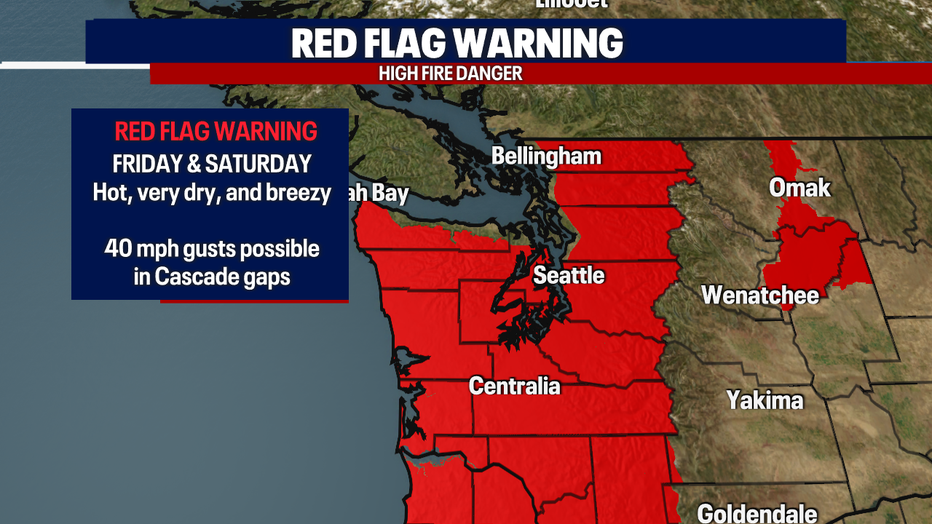
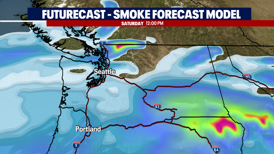
Smoke will also accompany these easterly winds. You'll likely notice an increase in hazy skies late Thursday and Friday morning. The smoke will likely linger through Sunday.
If Seattle hits 90 degrees on Saturday as forecast, it will be the 13th day this year with a high of 90 degrees or warmer. That would break the all time record for 90 degree days in a year.
Temperatures should cool dramatically by Monday as onshore flow brings in more cloud cover and marine air. "Nature's air conditioner" will drop temps close to seasonal averages early next workweek.