Seattle weather: Drier and warmer conditions through the weekend
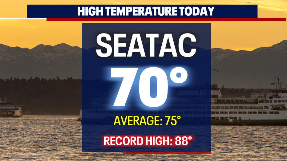
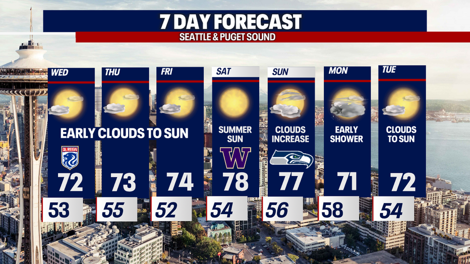
SEATTLE - Highs Tuesday were slightly warmer landing in the upper 60s to low 70s for the Central Sound. SeaTac hit 70 at the airport.
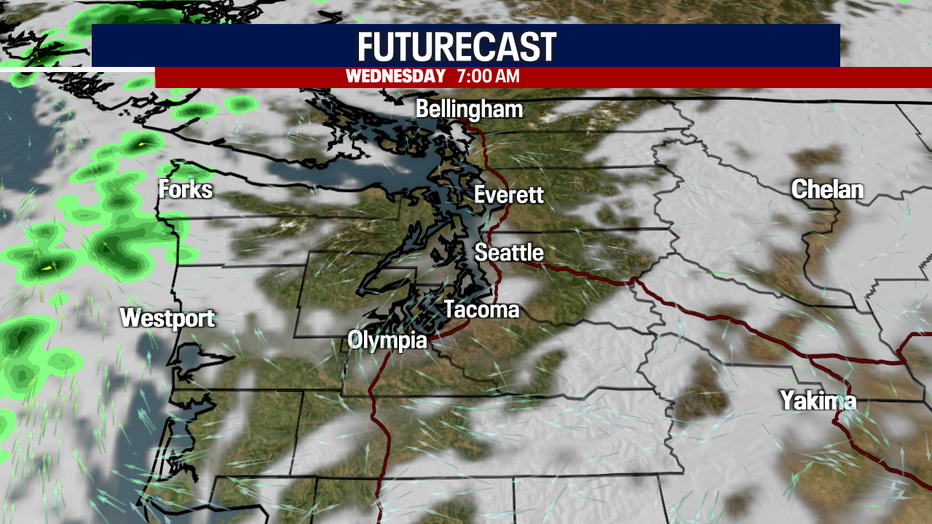
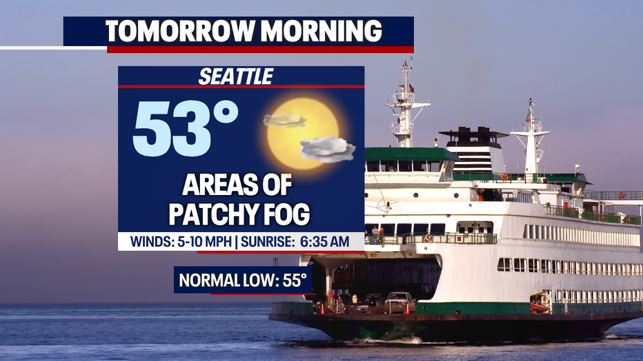
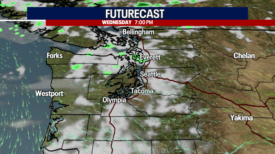
Clouds stream inland overnight for overcast skies, but by 7am most of the clouds move east into the Cascades. Some neighborhoods will see areas of patchy fog.
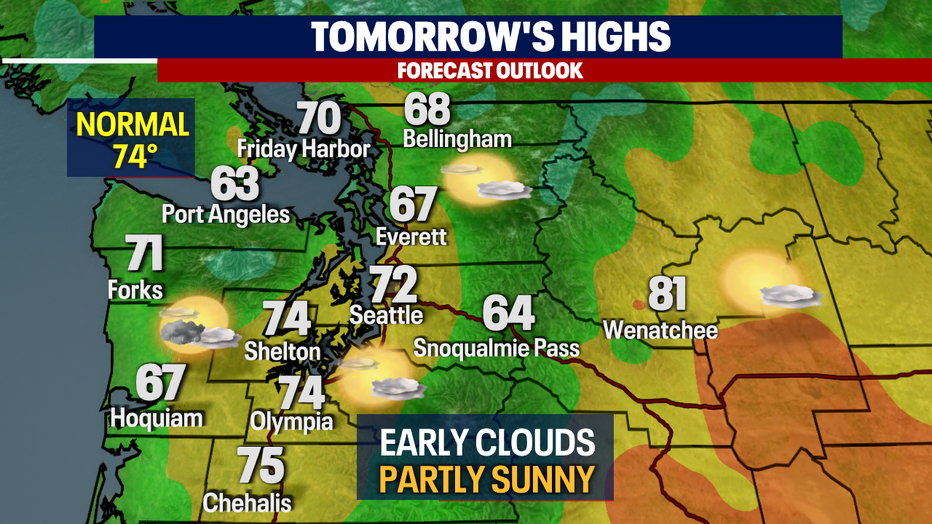
We start Wednesday with temperatures in the upper 40s to low 50s around the region. Keep your sunglasses handy for the morning and evening commutes.
Highs will warm into the low to mid 70s Seattle south with cooler highs, in the mid to upper 60s for North Sounders. Sky conditions are partly to mostly sunny.
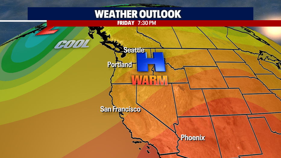
As we push to the end of the work week temperatures will continue to climb into the mid 70s as high pressure takes control.
The best day of the week to enjoy outdoor beauty across the PNW is Saturday with highs pushing to near 80s for several communities. These conditions are perfect for enjoying the UW Football team at home on Montlake taking on Tulsa. Make sure to wear sunscreen as temperatures for the 2 p.m. kick off are in the mid 70s.

We'll start to cool off slightly as we move into the second half of the weekend for the big game at Lumen Field between the Seahawks and Rams. Our skies are partly sunny with increasing clouds by dinner time. Highs land in the mid to upper 70s.
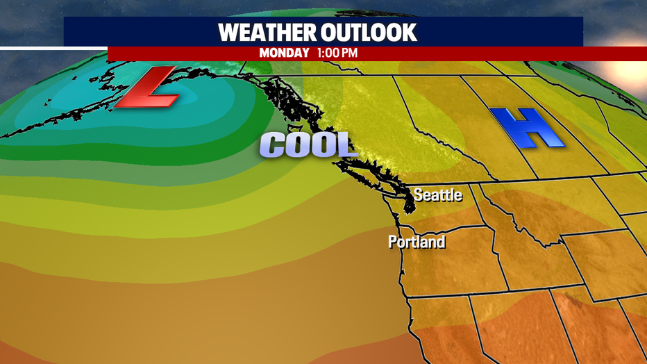
By Sunday night we'll start to feel some change as a cold front in the Pacific gives us a chance for a few late showers overnight into Monday. Temperatures will drop into the low 70s by Monday with this disturbance.
Tuesday is cool too with drier conditions. Enjoy!
Have a great rest of the week all! ~Erin Mayovsky, FOX 13 Forecaster
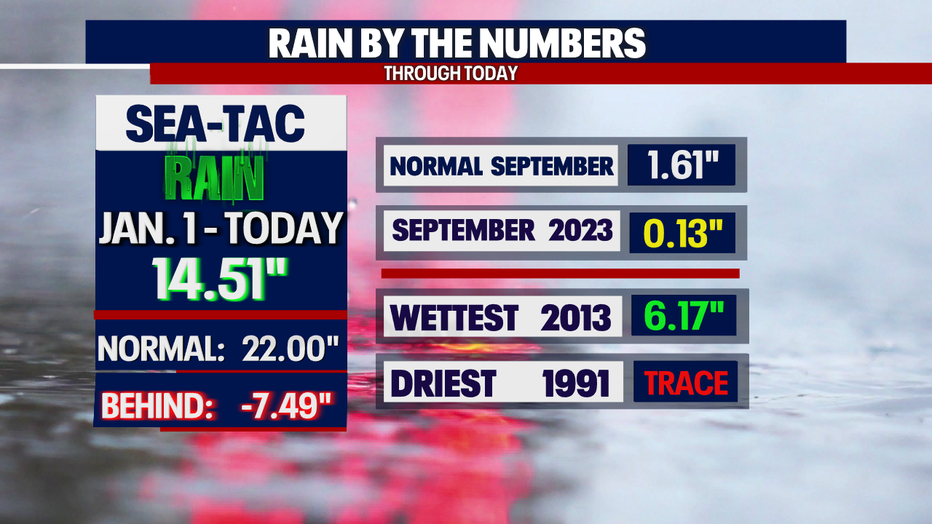
*SeaTac Rain Almanac
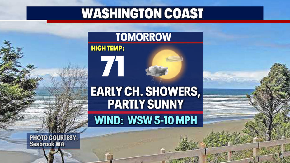
*Coast Forecast
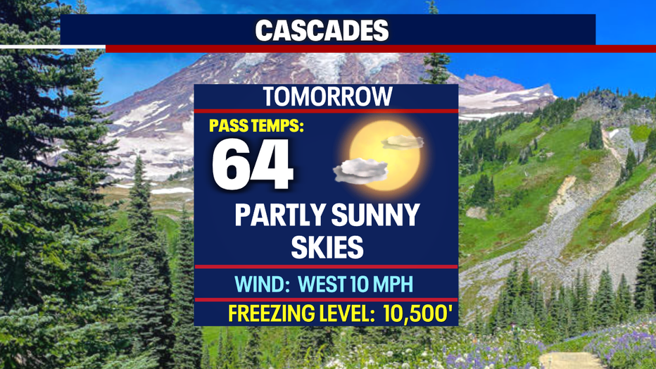
*Mountain Forecast
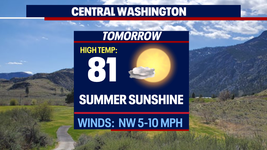
*Central WA Forecast