Seattle weather: Slow warm up this week as skies clear out
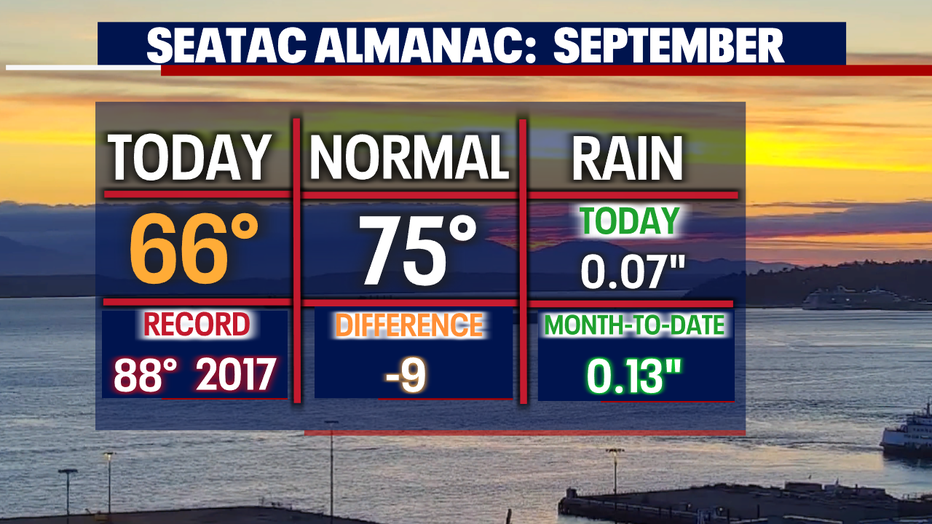
SEATTLE - Cool and cloudy this Labor Day across Western WA. The high at SeaTac just 66 and that's nine degrees below our average seasonal high for this time of year, 75.
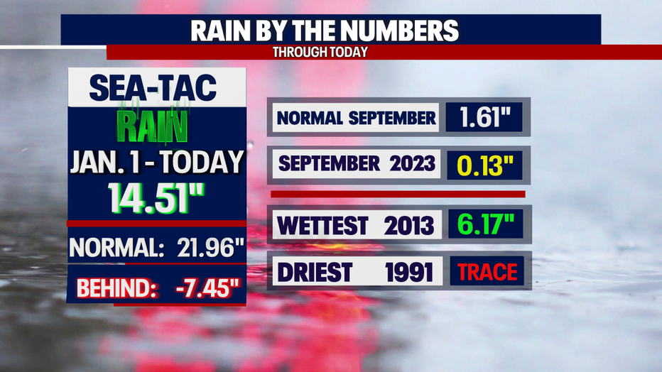
We did squeak out a small amount of rain at the airport too with just 0.07". We now sit at 0.13" for the month of September so far.
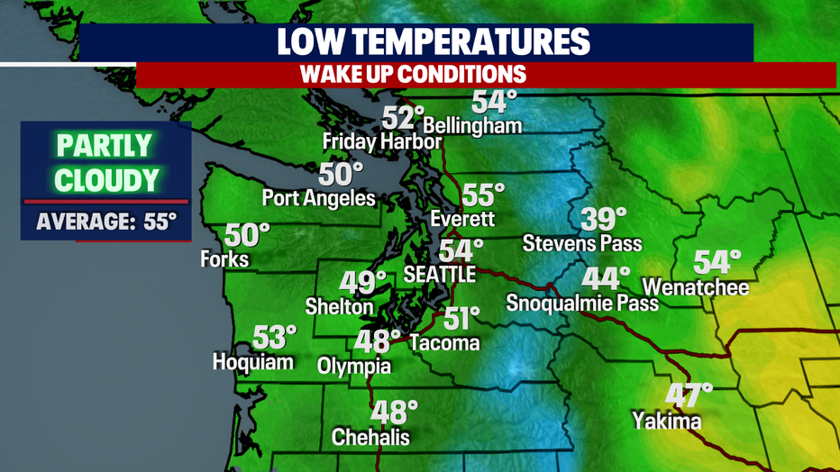
Skies are mostly to partly cloudy overnight with temperatures in the upper 40s to mid 50s from the coast inland. Look for some patchy fog early along the ocean beaches.
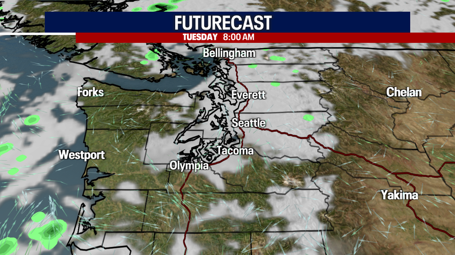
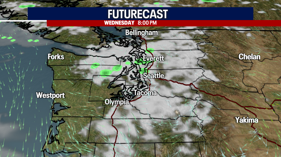
Clouds sit with us for the morning commute along the I-5 corridor between Olympia north to the Canadian border.
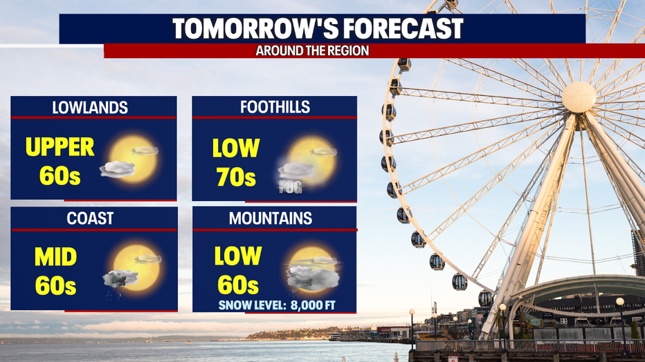
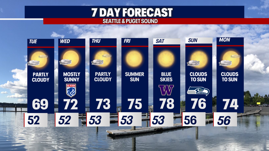
By midday clouds diminish giving way to some clearing for a partly sunny afternoon/evening. Highs still run cool in the upper 60s to low 70s.
Some areas later in the evening, like to the north, might see a little drizzle, otherwise we're mostly dry.
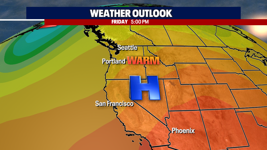
By Thursday into Friday high pressure to the south will help us stay warm and dry as we push into the weekend. Highs heat into the mid to upper 70s. These conditions are perfect for the UW Husky football team and Seahawks to play home games Saturday and Sunday!
We'll cool off slightly into next week with another chance for a few more showers.
Have a great week everyone! ~Erin Mayovsky, FOX 13 Forecaster
*SeaTac Rain Almanac
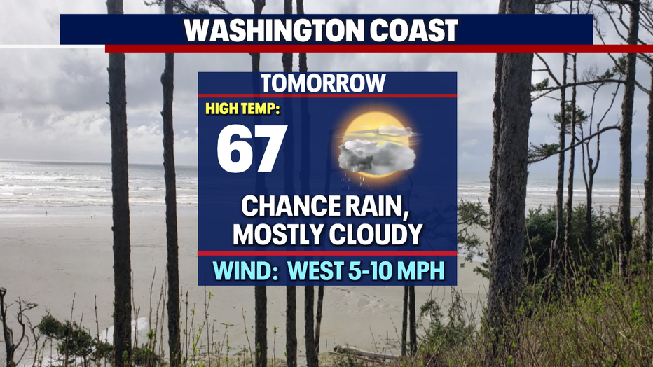
*Coast Forecast
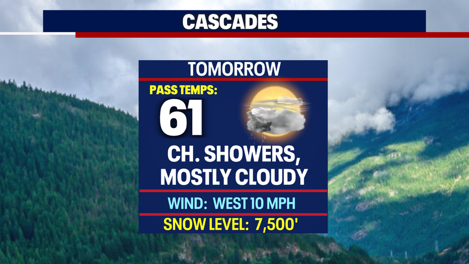
*Mountain Forecast
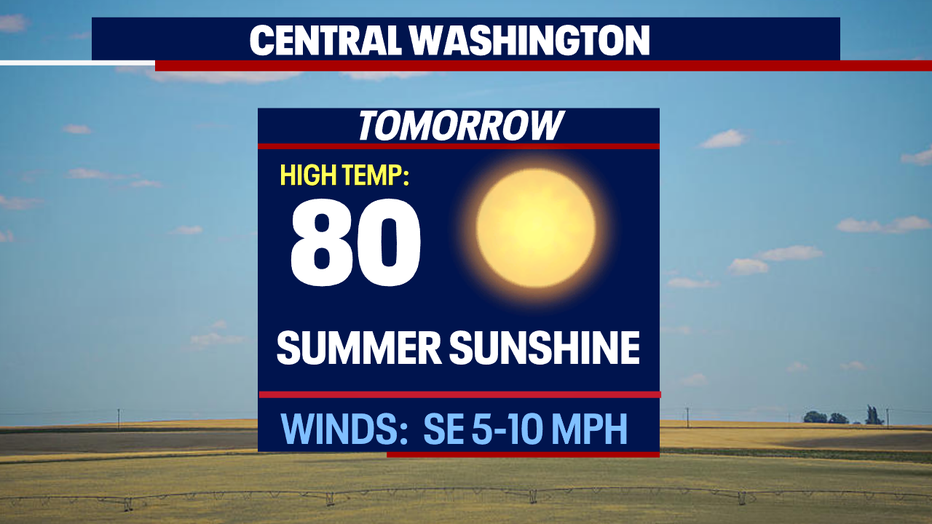
*Central WA Forecast