A cool & showery Thursday as our rollercoaster forecast continues
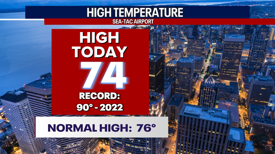
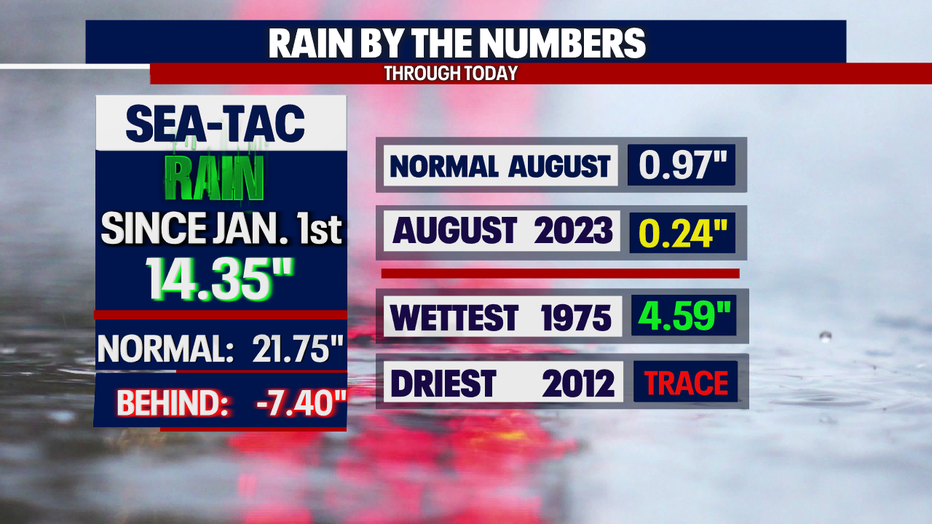
SEATTLE - Temperatures were cooler again today with just a trace of rain in the bucket at the airport. SeaTac hit 74 at the airport.
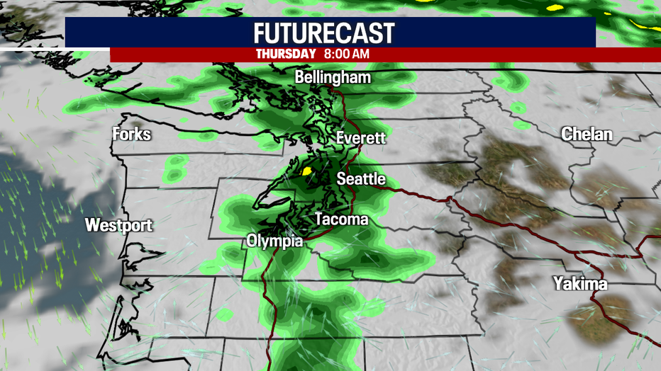
Low pressure will ride in overnight, opening the door for showers once again to blanket the region along with cooler temperatures.
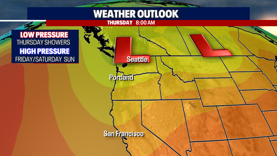
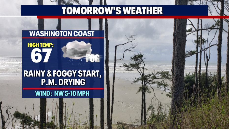
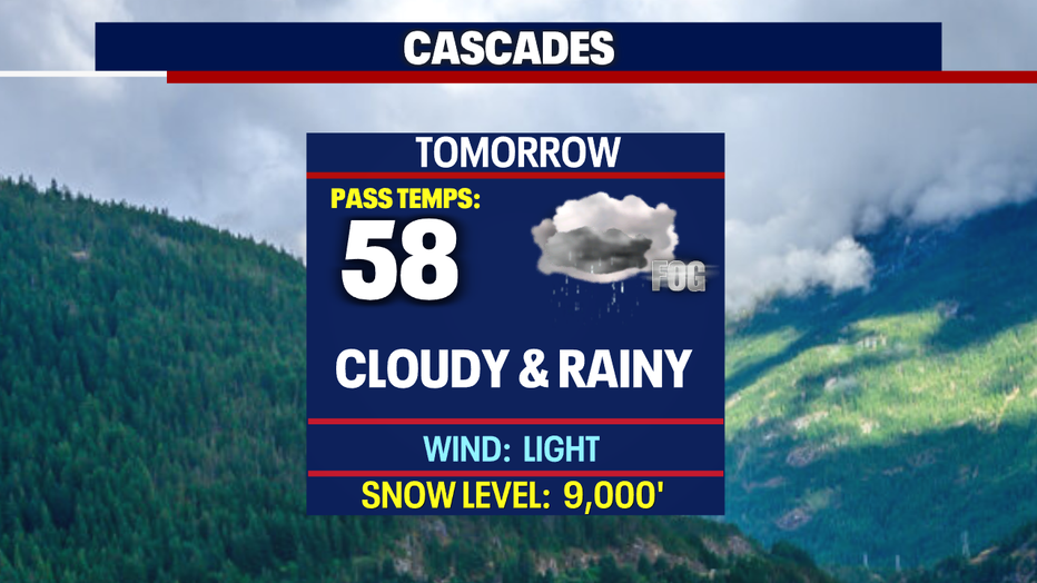
Your Thursday morning commute looks sloppy with moderate showers. Allow for extra time on the roads.
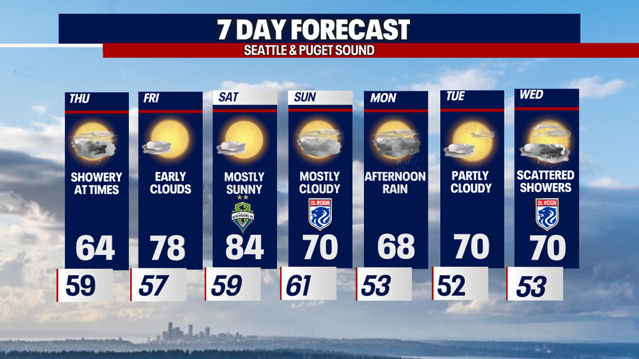
Wake up temperatures tomorrow are near 60 with highs only warming a few more degrees into the mid-60s. By the afternoon, showers will let up for a drier evening.
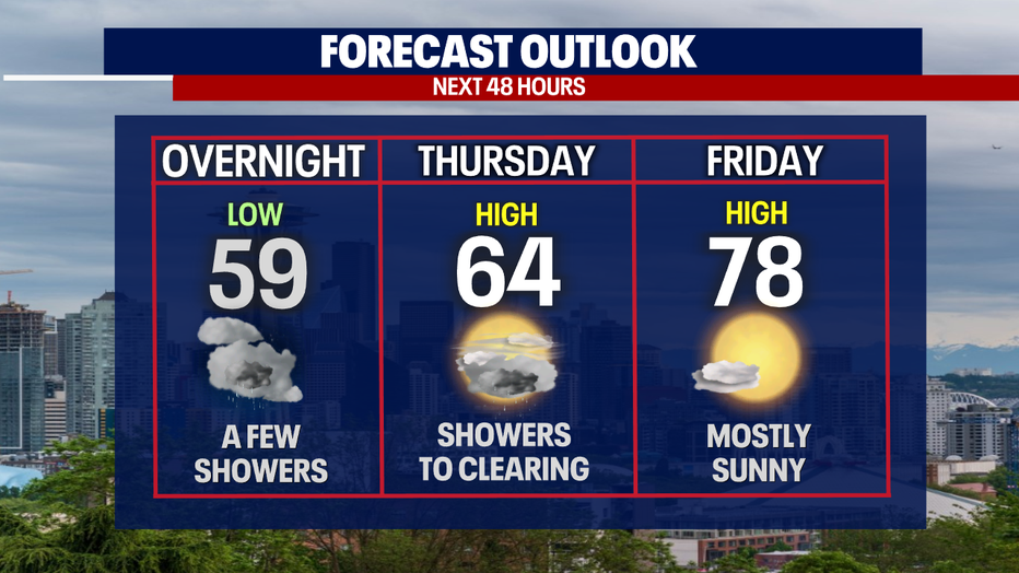
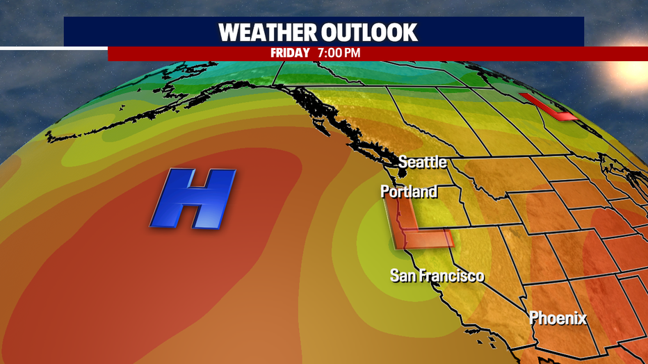
By Friday, high pressure in the Pacific will strengthen and move closer to the coast leaving us with drier and warmer conditions. Friday's highs cruise into the mid 70s.
Saturday heats up even more with highs near 80 under mostly sunny skies. But don't get used to those conditions as clouds return Sunday with another chance for showers later Monday. Temperatures drop back into upper 60s and 70s. Enjoy!
Have a great rest of the week all! ~Erin Mayovsky, FOX 13 Forecaster
*SeaTac Rain Almanac
*Coast Forecast
*Mountain Forecast
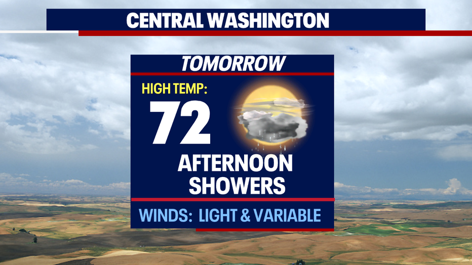
*Central WA Forecast