

70s to return to Seattle this week
Talk about an award-winning forecast! Not only will Seattle enjoy the mid 60s and sunshine today, the 70s could make a comeback by the end of the upcoming workweek.
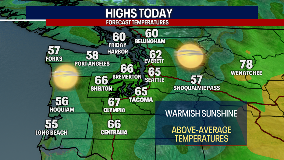
This afternoon, highs will reach the mid to upper 60s around Puget Sound. Temperatures for the coast will be cooler compared to yesterday thanks to increasing clouds today.

The Strait of Juan de Fuca will be gusty this afternoon through Monday morning. There's a Gale Warning in effect for the Strait as a result.
The Cascade "gap" communities (e.g. North Bend) could be blustery Monday, too.
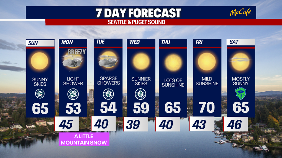
Tomorrow and Tuesday, highs cool to the low to mid 50s. You can plan on mostly cloudy skies Monday, and partly sunny skies on Tuesday. There's a slight chance for a light shower. There's even a possibility for minor mountain snow at times over the passes Monday to Tuesday.
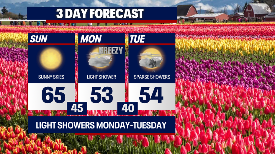
Skies clear Wednesday as temperatures reach almost 60. Warmth builds through the end of the workweek. Highs by Friday could boost to 70 degrees! Next weekend is looking dry and mild.
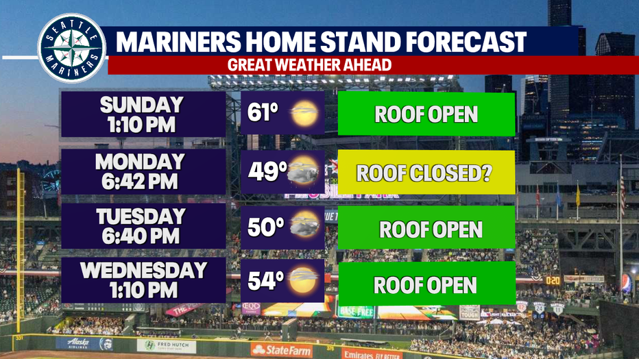
The roof for the Mariners game today should be open, but it could be closed tomorrow evening if showers develop. The roof will likely be open Tuesday night and Wednesday afternoon.
Stay tuned this week for further updates to the forecast! The extended forecast (beyond five days out) is particularly subject to change.
Enjoy the sunshine!
Warmly,
Meteorologist Abby Acone