

‘We’re all in this together’; DNR says Western WA at risk for severe wildfires this weekend
Red flag wildfire warnings issued in Washington this weekend
With 90 degree temperatures in the weather forecast, red flag warnings are in place to prevent new wildfires from popping up. As of Thursday morning, there are multiple fires burning across the state, decreasing air quality in some places of Puget Sound.
OLYMPIA, Wash. - The Washington State Department of Natural Resources (DNR) says the state’s weekend weather forecast is a recipe for severe wildfire danger. Though most of the wildfires currently burning in the state are east of the Cascades, the DNR is saying Western Washington will also need to stay vigilant.
According to the DNR, wildfires that ignite on the west side usually have little chance to explode in size, because of the regional climate. Moisture in the air coming from Puget Sound typically locks itself into the vegetation that would normally fuel a fire, like moss and grass. However, this weekend’s spiking temperatures and strong wind gusts could dry out those fuels, allowing a fire to spread much like a wildfire in Eastern Washington.
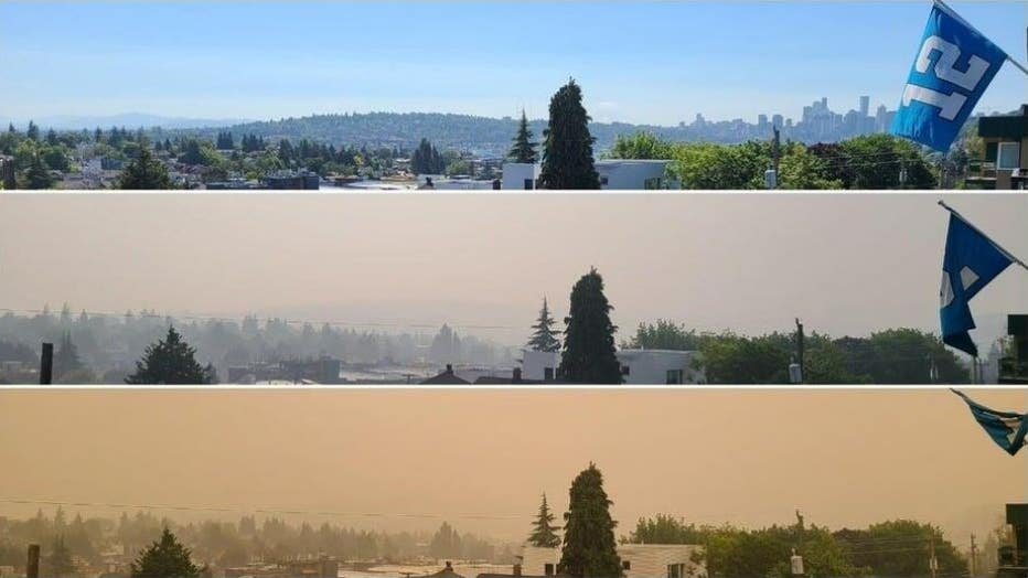
2020 Labor Day Wildfires: Photo at Fremont overlooking Capitol Hill and South Lake Union with wildfire smoke. Top photo 'normal' Seattle day, middle photo is Friday, and bottom photo shows wildfire smoke conditions on Saturday. Photo credit: Kurt Ric
In 2020, the historic Labor Day fires burned more than 330,000 acres across the state, and Commissioner of Public Lands Hilary Franz says this weekend’s weather forecast is dangerously similar.
"This weekend’s weather conditions hearken to the east wind event that contributed to the unpredictable fire behavior and rapid spread of the 2020 Labor Day weekend firestorm. Windy conditions amplify wildfire starts and make fighting those ignitions challenging."
FOX 13 WEATHER FORECAST
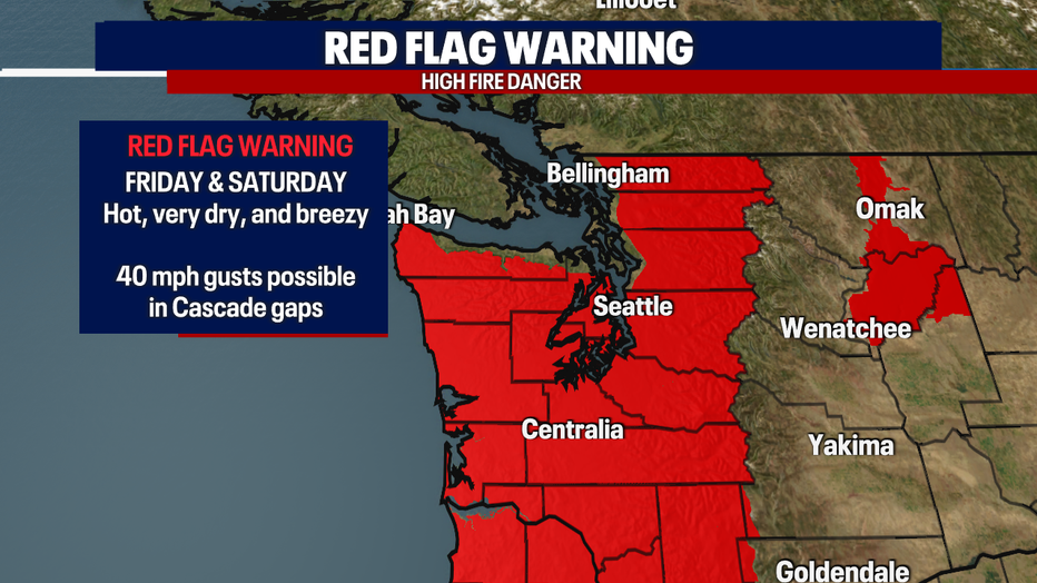
FOX 13’s Brian MacMillan is tracking red flag warnings Friday and Saturday.
Friday and Saturday will bring high fire danger to Western Washington as a ridge of high pressure moves overhead. Both days will be very warm with breezy easterly winds, especially in areas around the gaps of the Cascades. Gusts there could reach up to 40 mph. With this hot, dry, fast moving air incoming, a small wildfire can quickly grow.
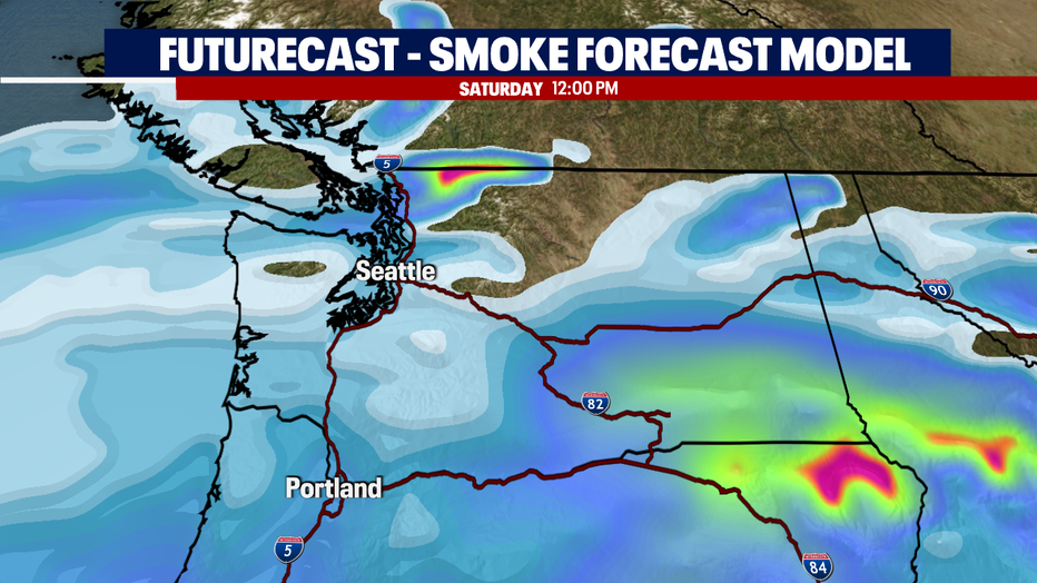
Smoke will also accompany these easterly winds. You'll likely notice an increase in hazy skies late Thursday and Friday morning. The smoke will likely linger through Sunday.
To view Brian's full seven-day weather forecast, click here.

Live map showing wildfires currently burning across Washington State as of September 8, 2022. (Website: https://inciweb.nwcg.gov/)
Aside from Western Washington, the DNR says these conditions could contribute to rapid growth for those significant wildfires that are already scorching areas in Eastern Washington.
"It’s important to remember that we’re all in this together," Franz said. "Practicing good prevention habits keeps our skies clear and our firefighters safe."
Fore more information from the DNR on fire prevention resources and best practices, click here.