Seattle Weather: A few more sunbreaks & milder temperatures Friday
A chilly Thursday with gray skies for most and scattered showers. Highs were almost 10 degrees below average.
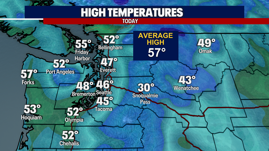
Scattered showers and clouds have been the story today around the Puget Sound area, with a few more sunbreaks along the coast.

Overnight lows will be chilly again with temperatures dropping into the low 40s. Mostly cloudy skies with a few sprinkles.

Waking up on Friday, we will see a mix of sun and clouds, more sunshine along the coast and a few snowflakes in the Cascades.

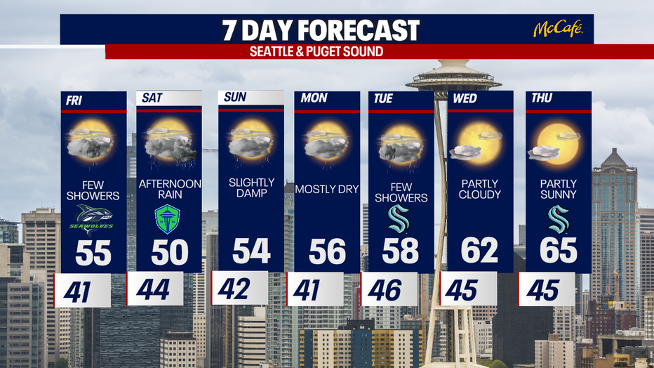
Mostly to partly cloudy skies on Friday with near average temperatures and a few scattered showers possible.
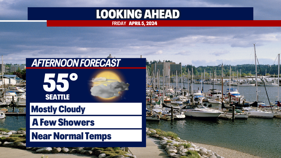
Highs will be back to near normal, in the mid to upper 50s.
A few scattered showers are possible in the evening with a few more inches of mountain snow.
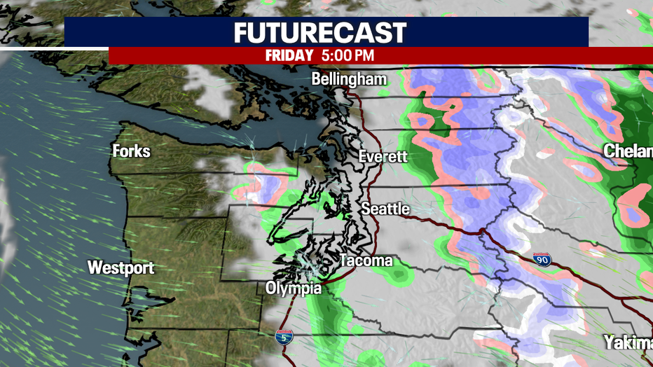
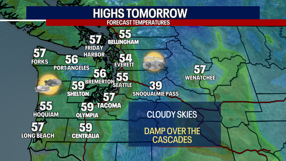
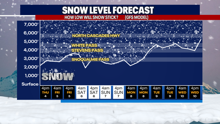
Snow levels will be around the passes through the weekend, so we could see a few more inches of spring snow!
Scattered showers and cooler temperatures will stick around through the weekend with a chance of storms in the afternoon Saturday and possibly Sunday. High pressure will start to build once again, with temperatures warming back up and skies drying out by mid-next week.