

End of arctic air on horizon with January thaw days away
As nearly the entire country faces the invasion of cold air, the end of the frigid weather is already in sight, as temperatures next week could return to 10-20 degrees above average.
According to the FOX Forecast Center, a ridge of high pressure is expected to situate itself off the mid-Atlantic, enabling southerly flow and bringing in much warmer weather.
The first signs of the warmup could start appearing across large parts of the country on Monday but intensify through the workweek.
The warm air will mean communities that usually only have highs in the 20s could reach the 30s, and those who typically see the 30s could top out in the 40s to close to 50 degrees.
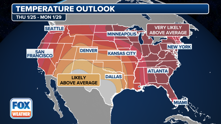
Temperature outlook(FOX Weather)
The winter warmup will mean a halt to much of the frozen precipitation east of the Mississippi River, as temperatures won’t be in place to support widespread snowfall and ice threats.
EL NINO APPEARS TO BE ON VERGE OF RAPID COLLAPSE
"We are going to have our own natural heater come next week, thankfully. Across the country, the entire Lower 48 expects to be above average in spots that were well below," said FOX Weather Meteorologist Jane Minar.
The warm-up appears similar to the weather pattern that dominated much of December, with an active subtropical jet bringing storminess along the Gulf Coast.
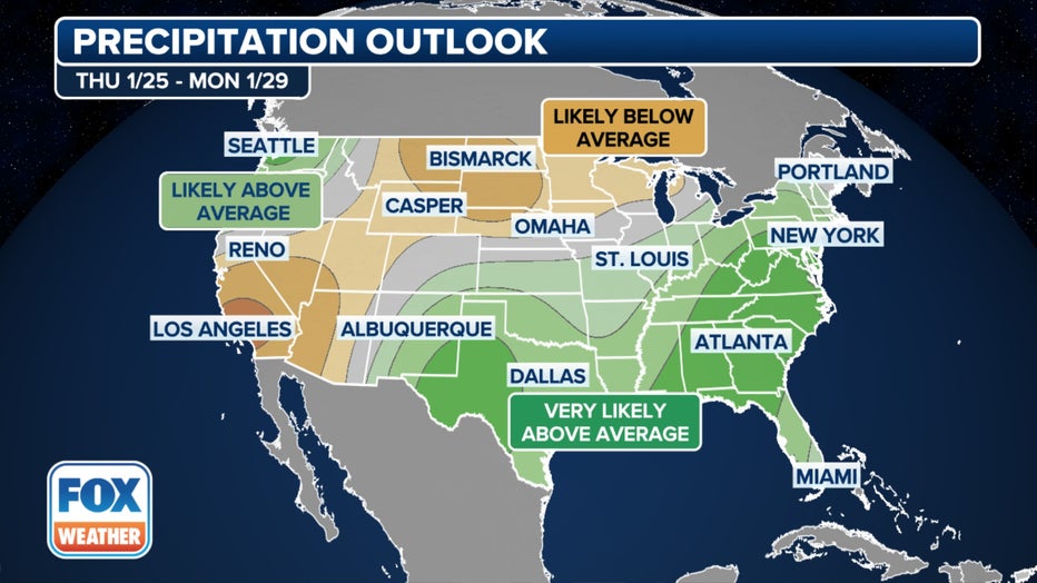
Precipitation Outlook(FOX Weather)
Early indications are that the air mass will fall short of record territory but will still be plenty noticeable and, for many, a significant change from the blizzard conditions that plagued regions mid-month.
For daily highs to be record-breaking for a city such as Duluth, Minnesota, temperatures must reach around the 50-degree mark to make it into the history books. And, again, that doesn’t appear to be in the cards with plenty of 30s in the forecast during the workweek, which is 10–20 degrees above average.
5 NEW YORK WOMEN FROM SAME FAMILY KILLED BY TRACTOR-TRAILER IN PENNSYLVANIA, REPORTS SAY
There remains considerable debate on how long the upcoming warm streak will last, with some climate models expecting the warm pattern to continue through the remaining days of winter, while some global models show a less pronounced warm spell, with average temperatures returning by the start of February.
NOAA forecasters noted the varying model runs in a recent climate outlook discussion.
"The building mid-level ridge in northwestern North America could presage a renewed outbreak of cold air in much of the CONUS beyond the week-2 period, but there is a lot of uncertainty due to the disparate solutions of the models toward the end of the period," the National Weather Service’s Climate Prediction Center stated.
Typically, the coldest period of winter for the country is during the third week of January, but some regions of the Midwest and Great Lakes don’t reach their typical coldest phase until around February.
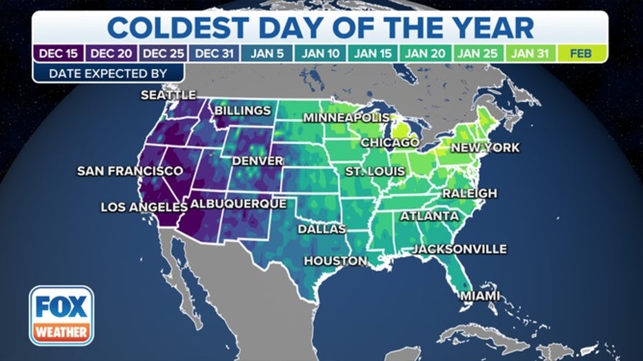
This map shows the dates you can expect the coldest low temperatures of the year to occur based on 30-year averages (1991-2020) from NOAA's National Centers for Environmental Information. (FOX Weather)