

High Wind Warning for Port Townsend and Whidbey Island tonight
SEATTLE -- A High Wind Warning is in effect until 1 a.m. Wednesday for the Admiralty Inlet area, which includes Whidbey Island and Port Townsend.
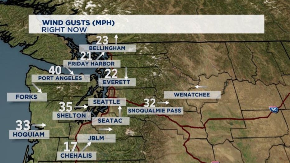
Q13 Meteorologist Rebecca Stevenson says winds picked up about 3 p.m. Tuesday afternoon. They are expected to get stronger.
Wind gusts of 40mph have been reported through the Strait of Juan de Fuca. 30mph winds have been reported on Whidbey Island.
The National Weather Services says west winds will increase throughout Tuesday afternoon, peaking from about 4 to 10 p.m.
Tuesday evening's wind shift will bring clouds and cooler temperatures for Wednesday and Thursday, but the warmer, sunny weather should return by Memorial Day weekend.
"The increase of wind will rush ocean air to Seattle and inland cities. Temperatures will continue to cool overnight with low clouds and areas of drizzle Wednesday morning," says Q13 Chief Meteorologist Walter Kelley.
Wednesday: Much cloudier and cooler in the low to mid-60s. Drizzle or light rain showers will develop for spots, most likely on the coast, I-90 corridor, north King county to Snohomish, Skagit, and Whatcom counties. Rain showers are expected in the Cascade mountains and lower foothills.
Thursday: Mostly cloudy with some afternoon clearing. Mountain showers with a slight chance of a thunderstorm in the afternoon. High temperatures will warm near 70°.
MEMORIAL DAY WEEKEND Friday through Monday: Each day will have areas of morning clouds and clearing to sunny by afternoon. High temperatures will warm from the mid-70s to low 80s.