

Warming temps this Father's Day weekend, 90 degrees likely for Seattle on Monday
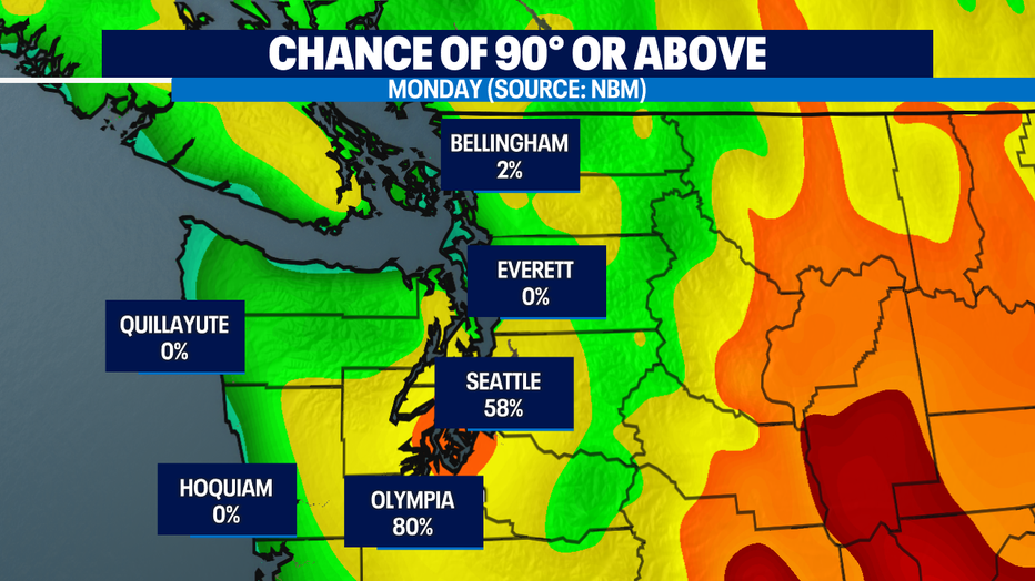
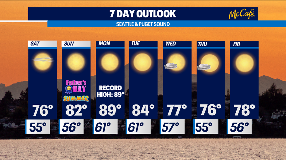
SEATTLE - Main weather headline: Will we hit 90° in Seattle on Monday? The latest NBM (National Blended Model) says there is a 58% probability at SeaTac, which is a bit down from yesterday's run. Chances are much better in Olympia (80%) and not likely at all on the coast and north of Seattle. Forecast remains on track for Monday's high at SeaTac to hit 89°, which will tie the record set back in 1992. Regardless, get ready for the heat.
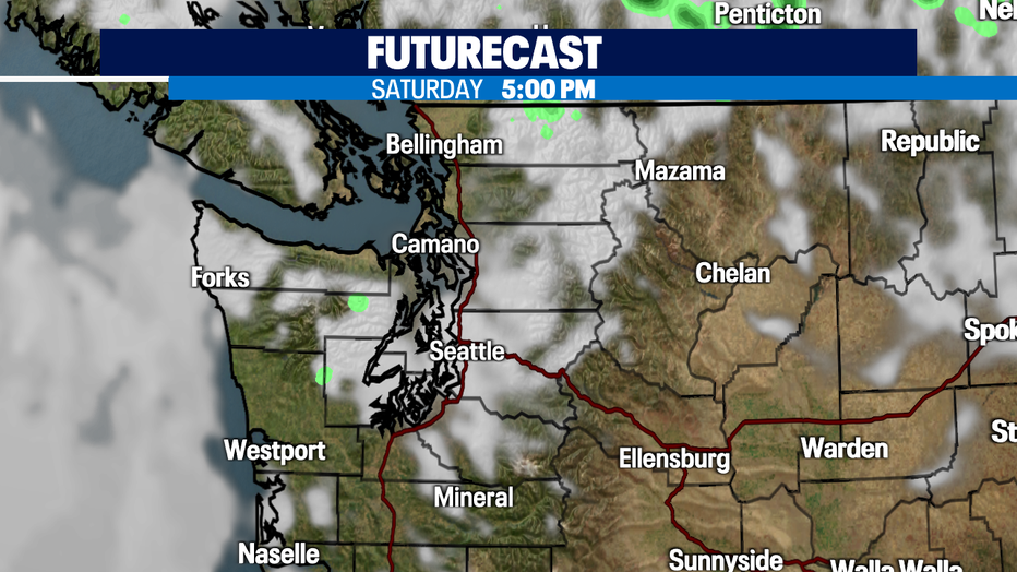
In the near term, a disturbance offshore will brush to our north, increasing clouds tonight. Lows will drop into the low to mid 50s. Clouds may still remain going into Saturday keeping afternoon highs mild in the low to mid 70s across the region. There is also a chance for sprinkles in Whatcom County and higher elevations.
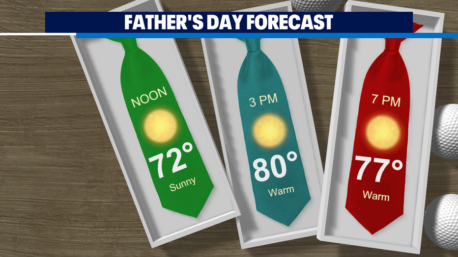
Upper level ridge will build in going into Sunday and set up over us, cranking our highs into the 80s and bring ample sunshine. Father's Day will be sunny and warm for any plans. If you plan to be outdoors, practice heat safety.
Monday's forecast is still on track to being the warmest day of the year! Typically we see our first 90° day around July 3, so this would be early if we hit it. Tuesday will still be warm but we will be back into the mid to upper 70s as we end the work week.
Stay cool everyone!
-Q13 Meteorologist Grace Lim
Q13 WEATHER RESOURCES:
DOWNLOAD: Q13 Weather and News Apps
WATCH: Forecast and Radar
READ: Closures and Delays
CHECK: Latest Weather Alerts and Live Traffic Map
INTERACT: Submit your Weather Photo
FOLLOW: Lisa Villegas, MJ McDermott, Tim Joyce, Erin Mayovsky, Grace Lim and Scott Sistek