

Here's why it looked like Mount Rainier was erupting earlier this week
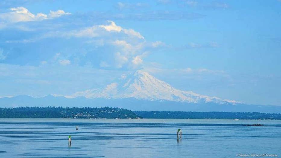
MOUNT RAINIER -- Did you happen to see the unique cloud formation over Mount Rainier earlier this week?
It looked almost as if a plume of smoke was erupting from the volcano. But don't worry, that was not the case.
The wind shifted direction from noon to 2pm and came from the south, pulling in a higher humidity.
Jason Shipley of Uniquely Northwest Photography shared this photo of Mount Rainier and the cloud that developed.
From this vantage point you are looking South -- the wind was traveling from the South/Southwest and bringing in more water vapor.
The extra water vapor plus the very warm rising air had a boost from lifting upslope by the mountainside.
So with three key lifting elements -- warm air, water vapor and windward mountain side -- the result on a clear day is an explosive building of a cumulus cloud.
The warm water vapor was a lot lighter in weight than the colder air around Rainier’s summit, so it was shooting up in the air -- building, building, building ... trying to make a thunderstorm!
Used with permission from Uniquely Northwest Photography/Jason Shipley