

Rain at times, Winter Storm Warning for mountains
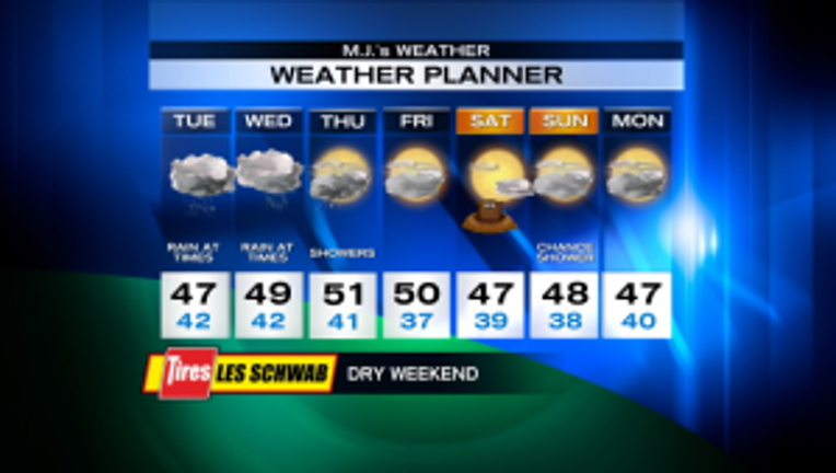
It's a rainy morning and we may have a little break, then it rains again during the afternoon/evening. Highs will be near normal, mid-to-upper 40s. The mountains continue to be pounded with heavy snow. The Winter Storm Warning continues there until 10 a.m. tomorrow morning. Passes could pick up another foot or 2 of snow. Gusty winds at times is making for poor visibility. There will be occasional stops for avalanche work today. If you can avoid the passes today, that would be a good idea. Tomorrow looks rainy with highs in the upper 40s. Showers taper off on Thursday and we'll warm up to near 50. Friday and Saturday look dry and partly-t0-mostly sunny. Will the groundhog see its shadow on Saturday morning? It could, unless fog gets in the way. Sunday looks mainly dry, but there is a chance of a shower. Monday could be dry again. Highs remain in the mid-to-upper 40s - near normal.
Viewer photos of the day . . .
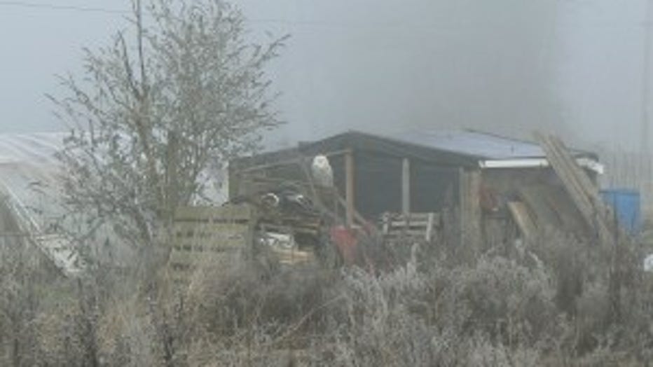
Snowy owl (see it?) on a foggy morning. From Dee in Monroe.

The ferry casting a shadow on Lopez Island on a sunny day. From Pat.